خط همرسمیت و سیتی
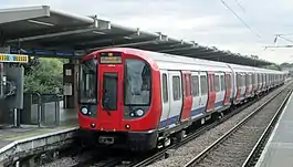
خط همرسمیت و سیتی (انگلیسی: Hammersmith & City line) یکی از خطهای متروی لندن است.
| خط همرسمیت و سیتی | |||
|---|---|---|---|
 | |||
 | |||
| اطلاعات کلی | |||
| ایستگاهها | ۲۹ | ||
| رنگ بر روی نقشه | صورتی عنابی | ||
| وبگاه | |||
| عملکرد | |||
| گونه | زیرسطحی | ||
| سیستم | متروی لندن | ||
| انبارها | Hammersmith[1] | ||
| خودروی ریلی | S7 Stock (7 carriages per trainset) | ||
| مسافرین | ۱۱۴٫۶ میلیون (۲۰۱۱/۱۲)[2] passenger journeys | ||
| تاریخچه | |||
| گشایش | Infrastructure opened in stages between 1863 and 1902, shown as a separate line on the tube map from 1990. | ||
| فنی | |||
| طول خط | ۲۵٫۵ کیلومتر (۱۵٫۸ مایل)[3] | ||
| اندازه ریل | ۱٬۴۳۵ mm (4 ft 8 1⁄2 in) ریل استاندارد | ||
| |||
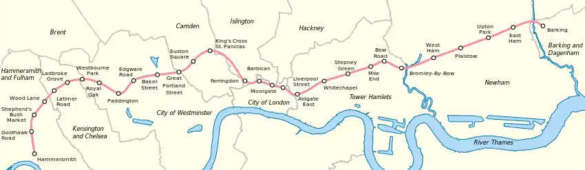
این خط که در سال ۱۸۶۴ راهاندازی شده دارای ۲۹ ایستگاه و ۲۵٫۵ کیلومتر طول میباشد. ایستگاه همرسمیت غربیترین ایستگاه و ایستگاه بارکینگ شرقیترین ایستگاه این خط است.
نقشه
ایستگاهها
| ایستگاه | تصویر | افتتاح[4] | اطلاعات | موقعیت |
|---|---|---|---|---|
| ایستگاه متروی همرسمیت | _station_building.JPG.webp) | 13 June 1864 | Moved to current position 1 December 1868.[4] | ۵۱°۲۹′۳۹″ شمالی ۰۰۰°۱۳′۳۰″ غربی |
| ایستگاه متروی گلدهاک رود | 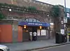 | 1 April 1914 | ۵۱°۳۰′۰۷″ شمالی ۰۰۰°۱۳′۳۷″ غربی | |
| ایستگاه متروی شپردز بوش مارکت | 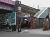 | 13 June 1864 | Moved to current position 1 April 1914.[4] Renamed from "Shepherd's Bush" in 2008.[5] | ۵۱°۳۰′۲۱″ شمالی ۰۰۰°۱۳′۳۵″ غربی |
| ایستگاه متروی وود لین | 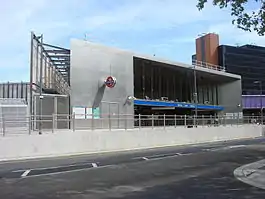 | 12 October 2008 | [6] | ۵۱°۳۰′۳۵″ شمالی ۰۰۰°۱۳′۲۷″ غربی |
| ایستگاه متروی لاتیمر رود | 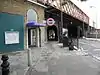 | 16 December 1868 | Closed between 17 January and 1 August 2011 for refurbishment and extension works[7] | ۵۱°۳۰′۵۰″ شمالی ۰۰۰°۱۳′۰۲″ غربی |
| ایستگاه متروی لدبروک گرو |  | 13 June 1864 | Opened as Notting Hill, renamed Notting Hill & Ladbroke Grove in 1880, Ladbroke Grove (North Kensington) in 1919 and Ladbroke Grove in 1938.[4] | ۵۱°۳۱′۰۲″ شمالی ۰۰۰°۱۲′۳۸″ غربی |
| ایستگاه متروی وستبورن پارک | 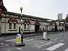 | 1 February 1866 | Moved to current position 1 November 1871,[4] and a Great Western main-line station until 1992.[8][9] | ۵۱°۳۱′۱۶″ شمالی ۰۰۰°۱۲′۰۴″ غربی |
| ایستگاه متروی رویال اوک | 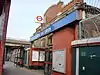 | 30 October 1871 | Also a Great Western main-line station until 1934.[10] | ۵۱°۳۱′۰۹″ شمالی ۰۰۰°۱۱′۱۷″ غربی |
| ایستگاه پادینگتون | 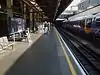 | 10 January 1863 | Opened as Paddington (Bishop's Road), renamed in 1948.[4] Connects with خط بیکرلو and خط ناحیه متروی لندن lines and ایستگاه پادینگتون main-line station. | ۵۱°۳۱′۰۷″ شمالی ۰۰۰°۱۰′۴۶″ غربی |
| ایستگاه متروی خیابان اجور | 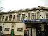 | 10 January 1863 | Connects with خط ناحیه متروی لندن and خط سیرکل lines. | ۵۱°۳۱′۱۲″ شمالی ۰۰۰°۱۰′۰۴″ غربی |
| ایستگاه متروی خیابان بیکر | 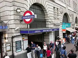 | 10 January 1863 | Connects with خط بیکرلو, خط جوبیلی and خط متروپولیتن lines. | ۵۱°۳۱′۱۹″ شمالی ۰۰۰°۰۹′۲۵″ غربی |
| ایستگاه متروی خیابان گریت پورتلند | 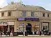 | 10 January 1863 | Opened as Portland Road, renamed Great Portland Street in 1917. Named Great Portland Street & Regent's Park 1923–33.[4] | ۵۱°۳۱′۲۶″ شمالی ۰۰۰°۰۸′۳۸″ غربی |
| ایستگاه متروی میدان یوستون | 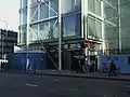 | 10 January 1863 | Opened as Gower Street and renamed in 1909.[4] Connects with Euston main-line station. | ۵۱°۳۱′۳۳″ شمالی ۰۰۰°۰۸′۰۹″ غربی |
| ایستگاه متروی کینگز کراس سنت پنکراس | 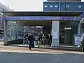 | 10 January 1863 | Opened as King's Cross, renamed King's Cross & St. Pancras in 1925 and King's Cross St. Pancras in 1933. Moved to current position in 1941.[4] Connects with خط شمالی متروی لندن, خط پیکدیلی and خط ویکتوریا lines ایستگاه راهآهن سنت پنکراس and ایستگاه راهآهن کینگز کراس لندن main-line stations. | ۵۱°۳۱′۴۹″ شمالی ۰۰۰°۰۷′۲۷″ غربی |
| ایستگاه فرینگدون | 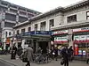 | 10 January 1863 | Opened as Farringdon Street, and moved to current position in 1865. Renamed Farringdon & High Holborn in 1922 and Farringdon in 1936.[4] Connects with تیمزلینک services. | ۵۱°۳۱′۱۲″ شمالی ۰۰۰°۰۶′۱۹″ غربی |
| ایستگاه متروی باربیکان |  | 23 December 1865 | Opened as Aldersgate Street, then Aldersgate in 1910, Aldersgate & Barbican in 1923 and Barbican in 1968.[4] | ۵۱°۳۱′۱۳″ شمالی ۰۰۰°۰۵′۵۲″ غربی |
| ایستگاه مورگیت | 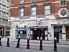 | 23 December 1865 | Opened as Moorgate Street, renamed in 1924.[4] Connects with خط شمالی متروی لندن line and the main line. | ۵۱°۳۱′۰۷″ شمالی ۰۰۰°۰۵′۱۹″ غربی |
| ایستگاه خیابان لیورپول | 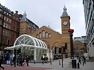 | 11 July 1875 | From February to July 1875 trains used platforms in the mainline station.[11] Connects with خط مرکزی متروی لندن and خط سیرکل lines and Liverpool Street mainline station. | ۵۱°۳۱′۰۴″ شمالی ۰۰۰°۰۴′۵۹″ غربی |
| ایستگاه متروی آلدگیت شرقی | 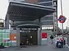 | 6 October 1884 | Connects with خط ناحیه متروی لندن line. Moved to current position in 1938.[4] | ۵۱°۳۰′۵۵″ شمالی ۰۰۰°۰۴′۲۰″ غربی |
| ایستگاه وایتچپل |  | 6 October 1884 | Connects with متروی زمینی لندن services. Opened as Whitechapel (Mile End), renamed in 1901. Metropolitan service began in 1906, and withdrawn 1913–36.[4] | ۵۱°۳۱′۰۸″ شمالی ۰۰۰°۰۳′۴۰″ غربی |
| ایستگاه متروی استپنی گرین | 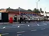 | 23 June 1902 | Metropolitan service began in 1941.[4] | ۵۱°۳۱′۱۹″ شمالی ۰۰۰°۰۲′۴۷″ غربی |
| ایستگاه متروی مایل اند | 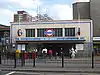 | 2 June 1902 | Cross platform interchange with خط مرکزی متروی لندن. Metropolitan service began in 1936.[4] | ۵۱°۳۱′۳۰″ شمالی ۰۰۰°۰۱′۵۹″ غربی |
| ایستگاه متروی بو رود | 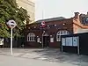 | 11 June 1902 | Main-line station opened in 1876 and moved in 1892.[12] Metropolitan service began in 1936,[4] main-line station closed in 1947.[12] | ۵۱°۳۱′۳۸″ شمالی ۰۰۰°۰۱′۲۹″ غربی |
| ایستگاه متروی براملی-بای-بو | 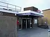 | 2 June 1902 | Opened as main-line station in 1894. First served as Bromley, Metropolitan service began in 1936, main-line station closed in 1940 and renamed in 1967.[4][13] | ۵۱°۳۱′۲۶″ شمالی ۰۰۰°۰۰′۴۱″ غربی |
| ایستگاه وستهام |  | 2 June 1902 | Connects with خط جوبیلی, قطار سبک داکلندز and c2c services. Main-line station opened 1901, Named West Ham (Manor Road) from 1924–69, Metropolitan service began in 1941 and main-line station closed 1994.[4][14] | ۵۱°۳۱′۴۱″ شمالی ۰۰۰°۰۰′۱۴″ شرقی |
| ایستگاه متروی پلاستو | 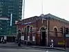 | 2 June 1902 | Main-line station opened in 1858.[15] Metropolitan service began in 1936.[4] | ۵۱°۳۱′۵۳″ شمالی ۰۰۰°۰۱′۰۲″ شرقی |
| ایستگاه متروی آپتون پارک | 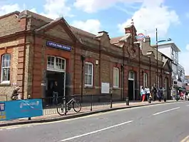 | 2 June 1902 | Main-line station opened in 1877.[16] Metropolitan service began in 1936.[4] | ۵۱°۳۲′۰۶″ شمالی ۰۰۰°۰۲′۰۴″ شرقی |
| ایستگاه متروی ایست هام | 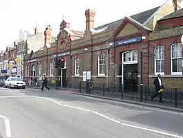 | 2 June 1902 | Main-line station opened in 1858.[17] Metropolitan service began in 1936.[4] | ۵۱°۳۲′۲۰″ شمالی ۰۰۰°۰۳′۰۶″ شرقی |
| ایستگاه بارکینگ | 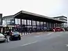 | 2 June 1902 | Connects with c2c, متروی زمینی لندن, and خط ناحیه متروی لندن services to Upminster. Main-line station opened in 1854.[18] District Railway service withdrawn 1905–8. Metropolitan service began in 1936.[4] | ۵۱°۳۲′۲۱″ شمالی ۰۰۰°۰۴′۵۴″ شرقی |
پانویس
- "London Underground Key Facts". Transport for London. Retrieved 21 May 2008.
- "Performance: LU Performance Data Almanac". Transport for London. 2011/12. Retrieved 17 January 2013. Check date values in:
|year=(help) - "Hammersmith & City line: Key Facts". tfl.gov.uk. Retrieved 28 November 2012.
- Rose 2007.
- "Modernisation complete as Shepherd's Bush Tube station re-opens" (Press release). Transport for London. 7 October 2008. Retrieved 6 February 2013.
- "New Wood Lane Underground station opens" (Press release). Transport for London. 14 October 2008. Retrieved 8 December 2012.
- "Latimer Road station to close for three months for engineering works" (Press release). Transport for London. 14 January 2011. Retrieved 7 February 2013.
- Butt 1995, p. 244.
- Leboff 1994, p. 152.
- Leboff 1994, p. 116.
- Jackson 1986, p. 70.
- Butt 1995, p. 41.
- Butt 1995, p. 45.
- Butt 1995, p. 245.
- Butt 1995, p. 186.
- Butt 1995, p. 238.
- Butt 1995, p. 88.
- Butt 1995, p. 27.
منابع
- مشارکتکنندگان ویکیپدیا. «Hammersmith & City line». در دانشنامهٔ ویکیپدیای انگلیسی، بازبینیشده در ۲۶ نوامبر ۲۰۱۵.
- Bruce, J Graeme (1983). Steam to Silver. A history of London Transport Surface Rolling Stock. Capital Transport. ISBN 0-904711-45-5.
- Butt, R. V. J. (1995). The Directory of Railway Stations: details every public and private passenger station, halt, platform and stopping place, past and present (1st ed.). Patrick Stephens Ltd. ISBN 1-85260-508-1.
- Green, Oliver (1987). The London Underground: An illustrated history. Ian Allan. ISBN 0-7110-1720-4.
- Horne, Mike (2003). The Metropolitan Line. Capital Transport. ISBN 1-85414-275-5.
- Horne, Mike (2006). The District Line. Capital Transport. ISBN 1-85414-292-5.
- Jackson, Alan (1986). London's Metropolitan Railway. David & Charles. ISBN 0-7153-8839-8.
- Leboff, David (1994). London Underground Stations. Ian Allan. ISBN 978-0-7110-2226-3.
- Rose, Douglas (December 2007) [1980]. The London Underground: A Diagrammatic History (8th ed.). Capital Transport. ISBN 978-1-85414-315-0.
- Wolmar, Christian (2004). The Subterranean Railway: how the London Underground was built and how it changed the city forever. Atlantic. ISBN 1-84354-023-1.
- London Railway Map. Quail Maps. 2001. ISBN 978-1-898319-54-2.
- Yonge, John (November 2008) [1994]. Jacobs, Gerald, ed. 5: Southern & TfL. Railway Track Diagrams (3rd ed.). Bradford on Avon: Trackmaps. ISBN 978-0-9549866-4-3.
پیوند به بیرون
| در ویکیانبار پروندههایی دربارهٔ خط همرسمیت و سیتی موجود است. |
- "Hammersmith & City Line". Clive's Underground Line Guides. 14 December 2007. Retrieved 11 July 2008.
- "Hammersmith & City Line Underground Stations – Facts, Trivia And Impressions". Randomly London. 8 August 2013. Retrieved 24 September 2013.
This article is issued from Wikipedia. The text is licensed under Creative Commons - Attribution - Sharealike. Additional terms may apply for the media files.
