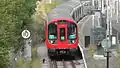
خط ناحیه متروی لندن
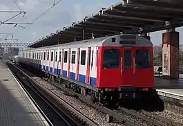
خط ناحیه متروی لندن (انگلیسی: District line) یکی از خطهای متروی لندن است.
| خط ناحیه متروی لندن | |||
|---|---|---|---|
 | |||
| اطلاعات کلی | |||
| ایستگاهها | ۶۰ | ||
| رنگ بر روی نقشه | سبز | ||
| عملکرد | |||
| گونه | زیرسطحی | ||
| سیستم | متروی لندن | ||
| انبارها | Upminster, Ealing Common (D Stock) Hammersmith (S stock) | ||
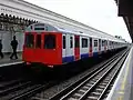
| خودروی ریلی | D78 (6 car) S7 (7 car) | ||
| مسافرین | ۲۰۸ میلیون (۲۰۱۱/۱۲)[1] passenger journeys | ||
| تاریخچه | |||
| گشایش | ۱۸۶۸ | ||
| فنی | |||
| طول خط | ۶۴ کیلومتر (۴۰ مایل) | ||
| اندازه ریل | 4 ft 8 1⁄2 in (۱٬۴۳۵ mm) | ||
| |||
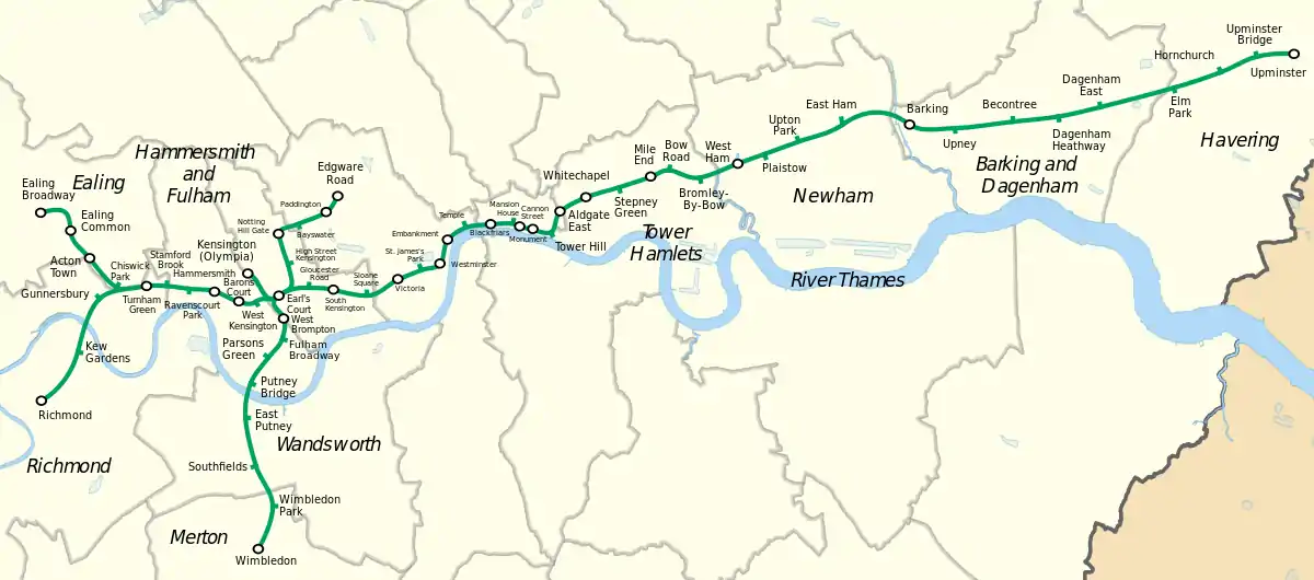
این خط که در سال ۱۸۶۸ راهاندازی شده دارای ۶۰ ایستگاه و ۶۴ کیلومتر طول میباشد. ایستگاه آپمینستر شرقیترین، ایستگاه ویمبلدون جنوبیترین، ایستگاه اجور رود شمالیترین و ایستگاه ایلینگ برادوی و ایستگاه ریچموند غربیترین ایستگاههای این خط هستند.
ایستگاهها
In order from west to east
| ایستگاه | تصویر | افتتاح[2] | شاخه | اطلاعات | موقعیت |
|---|---|---|---|---|---|
| ایستگاه ریچموند |  | ۱ اکتبر ۱۸۷۷ | Richmond | Connects with National Rail services. Opened by the L&SWR as Richmond New on 1 January 1869 and this amalgamated with the main line station in 1937.[3] | ۵۱°۲۷′۴۷″ شمالی ۰۰۰°۱۸′۰۰″ غربی |
| ایستگاه کیو گاردنز | 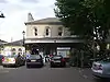 | ۱ اکتبر ۱۸۷۷ | Richmond | L&SWR station opened 1 January 1869[4] | ۵۱°۲۸′۳۸″ شمالی ۰۰۰°۱۷′۰۷″ غربی |
| ایستگاه گانرزبوری |  | ۱ اکتبر ۱۸۷۷ | Richmond | Connects with متروی زمینی لندن services. Opened by L&SWR as Brentford Road 1 January 1869, renamed 1871.[5] | ۵۱°۲۹′۳۰″ شمالی ۰۰۰°۱۶′۳۰″ غربی |
| ایستگاه ایلینگ برادوی | 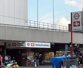 | ۱ ژوئیه ۱۸۷۹ | Ealing Broadway | Connects with National Rail services and خط مرکزی متروی لندن | ۵۱°۳۰′۵۳″ شمالی ۰۰۰°۱۸′۰۶″ غربی |
| ایستگاه متروی ایلینگ کامن |  | ۱ ژوئیه ۱۸۷۹ | Ealing Broadway | Connects with خط پیکدیلی. Between 1886 and 1910 known as Ealing Common and West Acton[2] | ۵۱°۳۰′۳۷″ شمالی ۰۰۰°۱۷′۱۷″ غربی |
| ایستگاه متروی آکتون تاون | 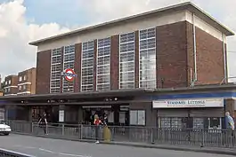 | ۱ ژوئیه ۱۸۷۹ | Ealing Broadway | Opened as Mill Hill Park, renamed 1 March 1910. Connects with Piccadilly line | ۵۱°۳۰′۱۰″ شمالی ۰۰۰°۱۶′۴۸″ غربی |
| ایستگاه متروی چیزویک پارک | 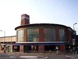 | ۱ ژوئیه ۱۸۷۹ | Ealing Broadway | Opened as Acton Green, renamed Chiswick Park and Acton Green in 1889, renamed 1910 | ۵۱°۲۹′۴۱″ شمالی ۰۰۰°۱۶′۰۴″ غربی |
| ایستگاه متروی تورنهام گرین |  | ۱ ژوئن ۱۸۷۷ | Main line | L&SWR station opened ۱ ژانویه ۱۸۶۹ | ۵۱°۲۹′۴۳″ شمالی ۰۰۰°۱۵′۱۸″ غربی |
| ایستگاه متروی استمفورد بروک | 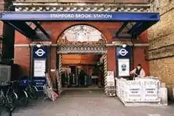 | ۱ فوریه ۱۹۱۲ | Main line | ۵۱°۲۹′۴۲″ شمالی ۰۰۰°۱۴′۴۵″ غربی | |
| ایستگاه متروی ریونتزکورت پارک |  | ۱ ژوئن ۱۸۷۷ | Main line | Opened as Shaftesbury Road by L&SWR on 1 April 1873, renamed ۱ مارس ۱۸۸۸ | ۵۱°۲۹′۳۹″ شمالی ۰۰۰°۱۴′۰۹″ غربی |
| ایستگاه متروی همرسمیت |  | ۱۵ دسامبر ۱۹۰۶ | Main line | Connects with Piccadilly line, خط همرسمیت و سیتی and خط سیرکلs | ۵۱°۲۹′۳۹″ شمالی ۰۰۰°۱۳′۳۰″ غربی |
| ایستگاه متروی برونز کورت |  | ۱۵ دسامبر ۱۹۰۶ | Main line | Connects with Piccadilly line | ۵۱°۲۹′۲۶″ شمالی ۰۰۰°۱۲′۴۹″ غربی |
| ایستگاه متروی کنزینگتون غربی | 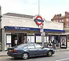 | ۹ سپتامبر ۱۸۷۴ | Main line | Opened as North End (Fulham),[6] renamed 1877 | ۵۱°۲۹′۲۷″ شمالی ۰۰۰°۱۲′۲۳″ غربی |
| ایستگاه ویمبلدون | 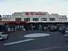 | ۳ ژوئن ۱۸۸۹ | Wimbledon branch | Connects with National Rail and تراملینک services. L&SWR station opened 21 May 1838. | ۵۱°۲۵′۲۴″ شمالی ۰۰۰°۱۲′۱۵″ غربی |
| ایستگاه متروی ویمبلدون پارک | 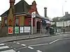 | ۳ ژوئن ۱۸۸۹ | Wimbledon branch | ۵۱°۲۶′۰۲″ شمالی ۰۰۰°۱۲′۰۰″ غربی | |
| ایستگاه متروی ساوتفیلدز | 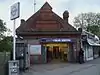 | ۳ ژوئن ۱۸۸۹ | Wimbledon branch | ۵۱°۲۶′۴۲″ شمالی ۰۰۰°۱۲′۲۵″ غربی | |
| ایستگاه متروی پاتنی شرقی | 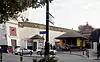 | ۳ ژوئن ۱۸۸۹ | Wimbledon branch | ۵۱°۲۷′۳۱″ شمالی ۰۰۰°۱۲′۴۱″ غربی | |
| ایستگاه متروی پانتی بریج | 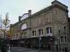 | ۱ مارس ۱۸۸۰ | Wimbledon branch | Opened as Putney Bridge & Fulham, renamed 1 January 1902 as Putney Bridge & Hurlingham, current name from 1932 | ۵۱°۲۸′۰۶″ شمالی ۰۰۰°۱۲′۳۲″ غربی |
| ایستگاه متروی پارسونز گرین | 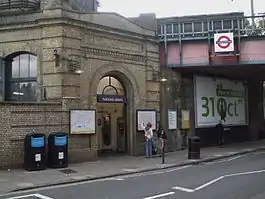 | ۱ مارس ۱۸۸۰ | Wimbledon branch | ۵۱°۲۸′۳۱″ شمالی ۰۰۰°۱۲′۰۴″ غربی | |
| ایستگاه متروی فولام برادوی |  | ۱ مارس ۱۸۸۰ | Wimbledon branch | Opened as Walham Green, renamed ۲ مارس ۱۹۵۲ | ۵۱°۲۸′۵۰″ شمالی ۰۰۰°۱۱′۴۱″ غربی |
| ایستگاه برامپتون غربی | 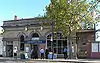 | ۱۲ آوریل ۱۸۶۹ | Wimbledon branch | Connects with National Rail and London Overground services. | ۵۱°۲۹′۱۲″ شمالی ۰۰۰°۱۱′۴۵″ غربی |
| ایستگاه کنزینگتون | 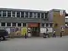 | ۲۰ دسامبر ۱۹۴۶ | Olympia branch | Connects with National Rail and London Overground services. The L&SWR opened a Kensington station on the West London Railway briefly in 1844. This station was opened on 2 June 1862 and was renamed Kensington Addison Road in 1868[7] and served by L&NWR, GWR, Metropolitan and other railways until services were withdrawn in 1940. Reopened as a branch of the District line in 1946.[8] | ۵۱°۲۹′۵۵″ شمالی ۰۰۰°۱۲′۳۹″ غربی |
| ایستگاه متروی ارلز کورت | 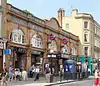 | ۱۵ دسامبر ۱۹۰۶ | Main line | Connects with Piccadilly line and all other District line services | ۵۱°۲۹′۲۹″ شمالی ۰۰۰°۱۱′۴۱″ غربی |
| ایستگاه مترویهای استریت کنزینگتون | 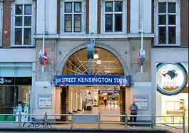 | ۱ اکتبر ۱۸۶۸ | Edgware branch | Opened as Kensington (High Street) and name gradually changed by 1880.[2] Connects with the Circle line. | ۵۱°۳۰′۰۳″ شمالی ۰۰۰°۱۱′۳۳″ غربی |
| ایستگاه متروی ناتینگ هیل گیت | 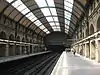 | ۱ اکتبر ۱۸۶۸ | Edgware branch | Connects with خط مرکزی متروی لندن. | ۵۱°۳۰′۳۲″ شمالی ۰۰۰°۱۱′۴۹″ غربی |
| ایستگاه متروی بیزواتر | 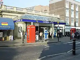 | ۱ اکتبر ۱۸۶۸ | Edgware branch | Opened as Bayswater, renamed Bayswater (Queen's Road) & Westbourne Grove in 1923, Bayswater (Queen's Road) in 1933 and Bayswater (Queensway) in 1946, after which the suffix was gradually dropped.[2] | ۵۱°۳۰′۴۳″ شمالی ۰۰۰°۱۱′۱۷″ غربی |
| ایستگاه پادینگتون |  | ۱ اکتبر ۱۸۶۸ | Edgware branch | Opened as Paddington (Praed Street), renamed in 1948.[2] Connects with خط بیکرلو and Paddington main line station. | |
| ایستگاه متروی خیابان اجور |  | ۱ اکتبر ۱۸۶۳ | Edgware branch | Connects with Circle and Hammersmith & City lines | ۵۱°۳۱′۱۲″ شمالی ۰۰۰°۱۰′۰۴″ غربی |
| ایستگاه متروی گلاستر رود | 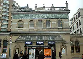 | ۱ اکتبر ۱۸۶۸ | Main line | Opened as Brompton (Gloucester Road), renamed in 1907.[2] Connects with Piccadilly and خط سیرکل lines | ۵۱°۲۹′۴۱″ شمالی ۰۰۰°۱۰′۵۹″ غربی |
| ایستگاه متروی کنزینگتون جنوبی | 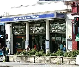 | ۲۴ دسامبر ۱۸۶۸ | Main line | Connects with خط پیکدیلی | ۵۱°۲۹′۳۹″ شمالی ۰۰۰°۱۰′۲۶″ غربی |
| ایستگاه متروی میدان اسلون |  | ۲۴ دسامبر ۱۸۶۸ | Main line | ۵۱°۲۹′۳۳″ شمالی ۰۰۰°۰۹′۲۴″ غربی | |
| ایستگاه ویکتوریا |  | ۲۴ دسامبر ۱۸۶۸ | Main line | Connects with خط ویکتوریا line and National Rail services. | ۵۱°۲۹′۴۸″ شمالی ۰۰۰°۰۸′۴۱″ غربی |
| ایستگاه متروی سنت جیمز پارک | 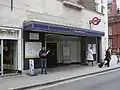 | ۲۴ دسامبر ۱۸۶۸ | Main line | ۵۱°۲۹′۵۸″ شمالی ۰۰۰°۰۸′۰۴″ غربی | |
| ایستگاه متروی وستمینستر | 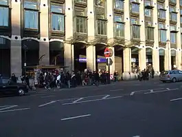 | ۲۴ دسامبر ۱۸۶۸ | Main line | Opened as Westminster Bridge, renamed in 1907.[2] Connects with خط جوبیلی | ۵۱°۳۰′۰۴″ شمالی ۰۰۰°۰۷′۳۰″ غربی |
| ایستگاه متروی امبانکمنت | 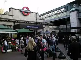 | ۳۰ مه ۱۸۷۰ | Main line | Opened as Charing Cross, renamed Charing Cross Embankment in 1974 and to the current name from 1976.[2] Connects with خط بیکرلو and خط شمالی متروی لندنs and Charing Cross National Rail station | ۵۱°۳۰′۲۵″ شمالی ۰۰۰°۰۷′۱۹″ غربی |
| ایستگاه متروی تمپل | 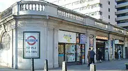 | ۳۰ مه ۱۸۷۰ | Main line | Opened as The Temple.[2] | ۵۱°۳۰′۴۰″ شمالی ۰۰۰°۰۶′۵۲″ غربی |
| ایستگاه بلکفرایرز | 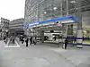 | ۳۰ مه ۱۸۷۰ | Main line | Connects with National Rail services. | ۵۱°۳۰′۴۲″ شمالی ۰۰۰°۰۶′۱۱″ غربی |
| ایستگاه متروی منشن هاوس | 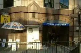 | ۳ ژوئیه ۱۸۷۱ | Main line | ۵۱°۳۰′۴۴″ شمالی ۰۰۰°۰۵′۳۹″ غربی | |
| ایستگاه خیابان کنن | 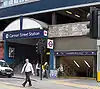 | ۶ اکتبر ۱۸۸۴ | Main line | Connects with National Rail services. | ۵۱°۳۰′۳۷″ شمالی ۰۰۰°۰۵′۲۷″ غربی |
| ایستگاههای بانک و مانیمنت | 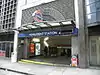 | ۶ اکتبر ۱۸۸۴ | Main line | Opened as Eastcheap, renamed The Monument in 1884.[2] Escalator connection to Bank station giving connections with خط مرکزی متروی لندن، خط شمالی متروی لندن، خط واترلو و سیتی and قطار سبک داکلندز. | ۵۱°۳۰′۴۷″ شمالی ۰۰۰°۰۵′۱۷″ غربی |
| ایستگاه متروی تاور هیل | 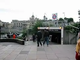 | ۲۵ سپتامبر ۱۸۸۲ | Main line | The Metropolitan Railway opened "Tower of London", however closed this in 1884 as the District Railway had opened "Mark Lane" nearby. This station was renamed "Tower Hill" in 1946 and moved to the site of the "Tower of London" station in 1967.[2][9] Connects with Circle line. | ۵۱°۳۰′۳۶″ شمالی ۰۰۰°۰۴′۳۴″ غربی |
| ایستگاه متروی آلدگیت شرقی | 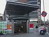 | ۶ اکتبر ۱۸۸۴ | Main line | Connects with Hammersmith & City line. Moved to current position in 1938.[2] | ۵۱°۳۰′۵۵″ شمالی ۰۰۰°۰۴′۲۰″ غربی |
| ایستگاه وایتچپل | 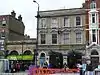 | ۶ اکتبر ۱۸۸۴ | Main line | Connects with متروی زمینی لندن services. Opened as Whitechapel (Mile End), renamed in 1901. | ۵۱°۳۱′۰۸″ شمالی ۰۰۰°۰۳′۴۰″ غربی |
| ایستگاه متروی استپنی گرین |  | ۲۳ ژوئن ۱۹۰۲ | Main line | ۵۱°۳۱′۱۹″ شمالی ۰۰۰°۰۲′۴۷″ غربی | |
| ایستگاه متروی مایل اند | 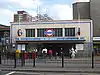 | ۲ ژوئن ۱۹۰۲ | Main line | Cross platform interchange with خط مرکزی متروی لندن. | ۵۱°۳۱′۳۰″ شمالی ۰۰۰°۰۱′۵۹″ غربی |
| ایستگاه متروی بو رود | 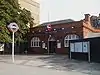 | ۱۱ ژوئن ۱۹۰۲ | Main line | ۵۱°۳۱′۳۸″ شمالی ۰۰۰°۰۱′۲۹″ غربی | |
| ایستگاه متروی براملی-بای-بو | 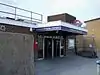 | ۲ ژوئن ۱۹۰۲ | Main line | Opened as LT&SR station in 1894. First served as Bromley, LT&SR station closed in 1940 and renamed in 1967.[2][10] | ۵۱°۳۱′۲۶″ شمالی ۰۰۰°۰۰′۴۱″ غربی |
| ایستگاه وستهام | 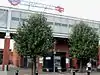 | ۲ ژوئن ۱۹۰۲ | Main line | Connects with خط جوبیلی، قطار سبک داکلندز and National Rail services. Named West Ham (Manor Road) from 1924–69, Metropolitan service began in 1941 and LT&SR station closed 1994.[2][11] | ۵۱°۳۱′۴۱″ شمالی ۰۰۰°۰۰′۱۴″ شرقی |
| ایستگاه متروی پلاستو | 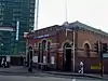 | ۲ ژوئن ۱۹۰۲ | Main line | LT&SR station opened in 1858.[12] | ۵۱°۳۱′۵۳″ شمالی ۰۰۰°۰۱′۰۲″ شرقی |
| ایستگاه متروی آپتون پارک | 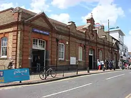 | ۲ ژوئن ۱۹۰۲ | Main line | LT&SR station opened in 1877.[13] | ۵۱°۳۲′۰۶″ شمالی ۰۰۰°۰۲′۰۴″ شرقی |
| ایستگاه متروی ایست هام | 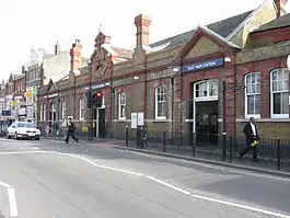 | ۲ ژوئن ۱۹۰۲ | Main line | LT&SR station opened in 1858.[14] | ۵۱°۳۲′۲۰″ شمالی ۰۰۰°۰۳′۰۶″ شرقی |
| ایستگاه بارکینگ |  | ۲ ژوئن ۱۹۰۲ | Main line | Connects with National Rail and London Overground. LT&SR station opened in 1854.[15] District Railway service withdrawn 1905–8.[2] | ۵۱°۳۲′۲۱″ شمالی ۰۰۰°۰۴′۵۴″ شرقی |
| ایستگاه متروی آپنی | 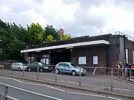 | ۱۲ سپتامبر ۱۹۳۲ | Main line | ۵۱°۳۲′۱۹″ شمالی ۰۰۰°۰۶′۰۵″ شرقی | |
| ایستگاه متروی بکونتری | 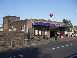 | ۱۲ سپتامبر ۱۹۳۲ | Main line | ۵۱°۳۲′۲۵″ شمالی ۰۰۰°۰۷′۳۷″ شرقی | |
| ایستگاه متروی دگنهام هیتوی |  | ۱۲ سپتامبر ۱۹۳۲ | Main line | Opened as Heathway, renamed 1949 | ۵۱°۳۲′۳۰″ شمالی ۰۰۰°۰۸′۴۹″ شرقی |
| ایستگاه متروی دگنهام شرقی |  | ۲ ژوئن ۱۹۰۲ | Main line | Opened as Dagenham in 1885,[16] District line service withdrawn 1905 to 1932 and station renamed 1949[2] | ۵۱°۳۲′۴۰″ شمالی ۰۰۰°۰۹′۵۶″ شرقی |
| ایستگاه متروی الم پارک | 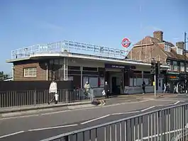 | ۱۳ مه ۱۹۳۵ | Main line | ۵۱°۳۲′۵۹″ شمالی ۰۰۰°۱۱′۵۲″ شرقی | |
| ایستگاه متروی هورنچرچ | 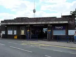 | ۲ ژوئن ۱۹۰۲ | Main line | LT&SR station opened 1885,[17] District line service withdrawn 1905 to 1932. | ۵۱°۳۳′۱۱″ شمالی ۰۰۰°۱۳′۰۸″ شرقی |
| ایستگاه متروی آپمینستر بریج | 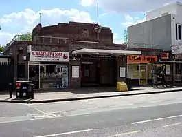 | ۱۷ دسامبر ۱۹۳۴ | Main line | ۵۱°۳۳′۲۹″ شمالی ۰۰۰°۱۴′۰۳″ شرقی | |
| ایستگاه آپمینستر |  | ۲ ژوئن ۱۹۰۲ | Main line | LT&SR station opened 1885,[18] District line service withdrawn 1905 to 1932. Connects with National Rail and London Overground services. | ۵۱°۳۳′۳۲″ شمالی ۰۰۰°۱۵′۰۴″ شرقی |
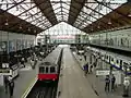
نگارخانه
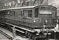 ۱۹۰۰ میلادی
منابع
- "Performance: LU Performance Data Almanac". Transport for London. 2011/12. Retrieved 17 January 2013. Check date values in:
|year=(help) - Rose 2007.
- Butt 1995, p. 197.
- Butt 1995, p. 131.
- Butt 1995, pp. 43, 111.
- Forgotten Stations of Greater London by J.E.Connor and B.Halford
- Butt 1995, p. 130.
- Horne 2006, pp. 15, 73.
- Jackson 1986, p. 110.
- Butt 1995, p. 45.
- Butt 1995, p. 245.
- Butt 1995, p. 186.
- Butt 1995, p. 238.
- Butt 1995, p. 88.
- Butt 1995, p. 27.
- Butt 1995, p. 75.
- Butt 1995, p. 123.
- Butt 1995, p. 237.
- مشارکتکنندگان ویکیپدیا. «District line». در دانشنامهٔ ویکیپدیای انگلیسی، بازبینیشده در ۲۵ نوامبر ۲۰۱۵.
- Bruce, J Graeme (1983). Steam to Silver. A history of London Transport Surface Rolling Stock. Capital Transport. ISBN 0-904711-45-5.
- Butt, R. V. J. (1995). The Directory of Railway Stations: details every public and private passenger station, halt, platform and stopping place, past and present (1st ed.). Patrick Stephens Ltd. ISBN 1-85260-508-1.
- Green, Oliver (1987). The London Underground: An illustrated history. Ian Allan. ISBN 0-7110-1720-4.
- Horne, Mike (2006). The District Line. Capital Transport. ISBN 1-85414-292-5.
- Jackson, Alan (1986). London's Metropolitan Railway. David & Charles. ISBN 0-7153-8839-8.
- Rose, Douglas (December 2007) [1980]. The London Underground: A Diagrammatic History (8th ed.). Capital Transport. ISBN 978-1-85414-315-0.
- London Railway Map. Quail Maps. 2001. ISBN 978-1-898319-54-2.
- Yonge, John (November 2008) [1994]. Jacobs, Gerald, ed. 5: Southern & TfL. Railway Track Diagrams (3rd ed.). Bradford on Avon: Trackmaps. ISBN 978-0-9549866-4-3.
پیوند به بیرون
| در ویکیانبار پروندههایی دربارهٔ خط ناحیه متروی لندن موجود است. |
- "District line facts". Transport for London. Retrieved 11 July 2008.
- "District Dave's London Underground Site". Retrieved 11 July 2008.
- "District Line". Clive's UndergrounD Line Guides. 15 April 2008. Retrieved 11 July 2008.
This article is issued from Wikipedia. The text is licensed under Creative Commons - Attribution - Sharealike. Additional terms may apply for the media files.