خط سیرکل
خط سیرکل (انگلیسی: Circle line) یکی از خطهای متروی لندن است.
| خط سیرکل | |||
|---|---|---|---|
.jpg.webp) S7 Stock train at Wood Lane, bound for Hammersmith. | |||
| اطلاعات کلی | |||
| ایستگاهها | ۳۶ | ||
| رنگ بر روی نقشه | زرد | ||
| عملکرد | |||
| گونه | زیرسطحی | ||
| سیستم | متروی لندن | ||
| انبارها | Hammersmith | ||
| خودروی ریلی | S Stock (7 cars per trainset) | ||
| مسافرین | ۱۱۴٫۶ میلیون (۲۰۱۱/۱۲)[persian-alpha 1][1] passenger journeys | ||
| تاریخچه | |||
| گشایش | ساخت و راهاندازی مابین ۱۸۶۳ تا ۱۸۸۴ | ||
| فنی | |||
| طول خط | ۲۷ کیلومتر (۱۷ مایل) | ||
| اندازه ریل | 4 ft 8 1⁄2 in (۱٬۴۳۵ mm) | ||
| |||
این خط که در سال ۱۸۸۴ راهاندازی شده دارای ۳۶ ایستگاه و ۲۷ کیلومتر طول میباشد، خط سیرکل دارای یک شاخه دایره شکل و یک شاخه فرعی و جداگانه است که در ایستگاه پدینگتون به یکدیگر اتصال دارند.
نقشه
ایستگاهها
| ایستگاه | تصویر | افتتاح[2] | اطلاعات | موقعیت |
|---|---|---|---|---|
| ایستگاه متروی همرسمیت | _station_building.JPG.webp) | ۱۳ ژوئن ۱۸۶۴ | Moved to current position 1 December 1868.[2] | ۵۱°۲۹′۳۹″ شمالی ۰۰۰°۱۳′۳۰″ غربی |
| ایستگاه متروی گلدهاک رود | 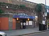 | ۱ آوریل ۱۹۱۴ | ۵۱°۳۰′۰۷″ شمالی ۰۰۰°۱۳′۳۷″ غربی | |
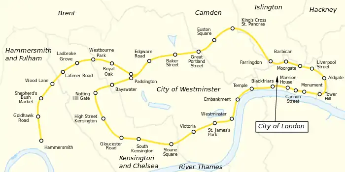
| ایستگاه متروی شپردز بوش مارکت | 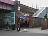 | ۱۳ ژوئن ۱۸۶۴ | Moved to current position 1 April 1914.[2] Renamed from "Shepherd's Bush" in 2008.[3] | ۵۱°۳۰′۲۱″ شمالی ۰۰۰°۱۳′۳۵″ غربی |
| ایستگاه متروی وود لین |  | ۱ مه ۱۹۰۸ | Open as Wood Lane (Exhibition) 1908–14 and as required from 1920 as Wood Lane (White City). Renamed White City in 1947 and closed in 1959,[2] until re-opened as Wood Lane on 12 October 2008.[4] | ۵۱°۳۰′۳۵″ شمالی ۰۰۰°۱۳′۲۷″ غربی |
| ایستگاه متروی لاتیمر رود | 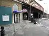 | ۱۶ دسامبر ۱۸۶۸ | Closed from 17 January to 1 August 2011 for engineering and refurbishment works.[5] | ۵۱°۳۰′۵۰″ شمالی ۰۰۰°۱۳′۰۲″ غربی |
| ایستگاه متروی لدبروک گرو |  | ۱۳ ژوئن ۱۸۶۴ | Opened as Notting Hill, renamed Notting Hill & Ladbroke Grove in 1880, Ladbroke Grove (North Kensington) in 1919, and Ladbroke Grove in 1938.[2] | ۵۱°۳۱′۰۲″ شمالی ۰۰۰°۱۲′۳۸″ غربی |
| ایستگاه متروی وستبورن پارک | 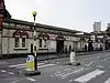 | ۱ فوریه ۱۸۶۶ | Moved to current position 1 November 1871,[2] and a Great Western main-line station from 1871 to 1992.[6] | ۵۱°۳۱′۱۶″ شمالی ۰۰۰°۱۲′۰۴″ غربی |
| ایستگاه متروی رویال اوک | 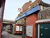 | ۳۰ اکتبر ۱۸۷۱ | Also a Great Western main line station after opening.[7]until 1934 | ۵۱°۳۱′۰۹″ شمالی ۰۰۰°۱۱′۱۷″ غربی |
| ایستگاه پادینگتون | 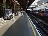 | ۱۰ ژانویه ۱۸۶۳ | Opened as Paddington (Bishop's Road), renamed in 1948.[2] Connects with خط بیکرلو and خط ناحیه متروی لندن lines and ایستگاه پادینگتون main line station. | ۵۱°۳۱′۰۷″ شمالی ۰۰۰°۱۰′۴۶″ غربی |
| ایستگاه متروی خیابان اجور | 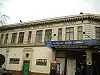 | ۱۰ ژانویه ۱۸۶۳ | Connects with خط ناحیه متروی لندن and the anti-clockwise Circle line. | ۵۱°۳۱′۱۲″ شمالی ۰۰۰°۱۰′۰۴″ غربی |
| ایستگاه متروی خیابان بیکر | 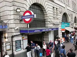 | ۱۰ ژانویه ۱۸۶۳ | Connects with خط بیکرلو، خط جوبیلی and خط متروپولیتن lines. | ۵۱°۳۱′۱۹″ شمالی ۰۰۰°۰۹′۲۵″ غربی |
| ایستگاه متروی خیابان گریت پورتلند | 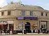 | ۱۰ ژانویه ۱۸۶۳ | Opened as Portland Road, renamed Great Portland Street in 1917. Named Great Portland Street & Regent's Park 1923–33.[2] | ۵۱°۳۱′۲۶″ شمالی ۰۰۰°۰۸′۳۸″ غربی |
| ایستگاه متروی میدان یوستون | 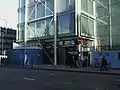 | ۱۰ ژانویه ۱۸۶۳ | Opened as Gower Street and renamed in 1909.[2] Street connection with Euston main line station. | ۵۱°۳۱′۳۳″ شمالی ۰۰۰°۰۸′۰۹″ غربی |
| ایستگاه متروی کینگز کراس سنت پنکراس | 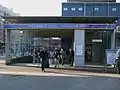 | ۱۰ ژانویه ۱۸۶۳ | Opened as King's Cross, renamed King's Cross & St. Pancras in 1925 and King's Cross St. Pancras in 1933. Moved to current position in 1941.[2] Connects with خط شمالی متروی لندن، خط پیکدیلی and خط ویکتوریا lines and ایستگاه راهآهن سنت پنکراس and ایستگاه راهآهن کینگز کراس لندن main line stations. | ۵۱°۳۱′۴۹″ شمالی ۰۰۰°۰۷′۲۷″ غربی |
| ایستگاه فرینگدون | 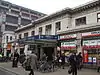 | ۱۰ ژانویه ۱۸۶۳ | Opened as Farringdon Street, and moved to current position in 1865. Renamed Farringdon & High Holborn in 1922 and Farringdon in 1936.[2] Connects with تیمزلینک services. | ۵۱°۳۱′۱۲″ شمالی ۰۰۰°۰۶′۱۹″ غربی |
| ایستگاه متروی باربیکان |  | ۲۳ دسامبر ۱۸۶۵ | Opened as Aldersgate Street, then Aldersgate in 1910, Aldersgate & Barbican in 1923 and Barbican in 1968.[2] | ۵۱°۳۱′۱۳″ شمالی ۰۰۰°۰۵′۵۲″ غربی |
| ایستگاه مورگیت | 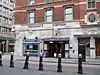 | ۲۳ دسامبر ۱۸۶۵ | Opened as Moorgate Street, renamed in 1924.[2] Connects with خط شمالی متروی لندن line and the main line Northern City Line | ۵۱°۳۱′۰۷″ شمالی ۰۰۰°۰۵′۱۹″ غربی |
| ایستگاه خیابان لیورپول | 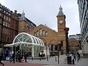 | ۱۱ ژوئیه ۱۸۷۵ | From February to July 1875 trains used platforms in the mainline station.[8] Connects with خط مرکزی متروی لندن and خط همرسمیت و سیتی lines and Liverpool Street mainline station. | ۵۱°۳۱′۰۴″ شمالی ۰۰۰°۰۴′۵۹″ غربی |
| ایستگاه متروی آلدگیت | 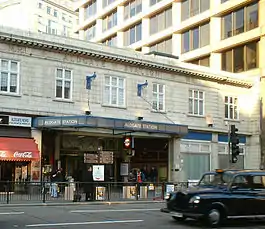 | ۱۸ نوامبر ۱۸۷۶ | ۵۱°۳۰′۵۰″ شمالی ۰۰۰°۰۴′۳۴″ غربی | |
| ایستگاه متروی تاور هیل | 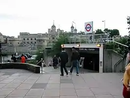 | ۲۵ سپتامبر ۱۸۸۲ | The Metropolitan Railway opened "Tower of London", however closed this in 1884 as the District Railway had opened "Mark Lane" nearby. This station was renamed "Tower Hill" in 1946 and moved to the site of the "Tower of London" station in 1967.[2][9] Connects with District line. | ۵۱°۳۰′۳۶″ شمالی ۰۰۰°۰۴′۳۴″ غربی |
| ایستگاههای بانک و مانیمنت |  | ۶ اکتبر ۱۸۸۴ | Opened as Eastcheap, renamed The Monument in 1884.[2] Escalator connection to Bank station giving connections with خط مرکزی متروی لندن، خط شمالی متروی لندن، خط واترلو و سیتی and قطار سبک داکلندز. | ۵۱°۳۰′۴۷″ شمالی ۰۰۰°۰۵′۱۷″ غربی |
| ایستگاه خیابان کنن | 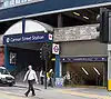 | ۶ اکتبر ۱۸۸۴ | Connects with Cannon Street main line station. | ۵۱°۳۰′۳۷″ شمالی ۰۰۰°۰۵′۲۷″ غربی |
| ایستگاه متروی منشن هاوس |  | ۳ ژوئیه ۱۸۷۱ | ۵۱°۳۰′۴۴″ شمالی ۰۰۰°۰۵′۳۹″ غربی | |
| ایستگاه بلکفرایرز | 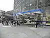 | ۳۰ مه ۱۸۷۰ | Connects with Blackfriars main line station and تیمزلینک services. | ۵۱°۳۰′۴۲″ شمالی ۰۰۰°۰۶′۱۱″ غربی |
| ایستگاه متروی تمپل | 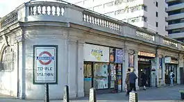 | ۳۰ مه ۱۸۷۰ | Opened as The Temple.[2] | ۵۱°۳۰′۴۰″ شمالی ۰۰۰°۰۶′۵۲″ غربی |
| ایستگاه متروی امبانکمنت | 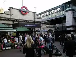 | ۳۰ مه ۱۸۷۰ | Opened as Charing Cross, renamed Charing Cross Embankment in 1974 and to the current name from 1976.[2] Connects with خط بیکرلو and خط شمالی متروی لندنs and Charing Cross main line station | ۵۱°۳۰′۲۵″ شمالی ۰۰۰°۰۷′۱۹″ غربی |
| ایستگاه متروی وستمینستر | 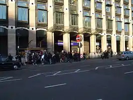 | ۲۴ دسامبر ۱۸۶۸ | Opened as Westminster Bridge, renamed in 1907.[2] Connects with خط جوبیلی | ۵۱°۳۰′۰۴″ شمالی ۰۰۰°۰۷′۳۰″ غربی |
| ایستگاه متروی سنت جیمز پارک | 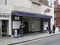 | ۲۴ دسامبر ۱۸۶۸ | ۵۱°۲۹′۵۸″ شمالی ۰۰۰°۰۸′۰۴″ غربی | |
| ایستگاه ویکتوریا | 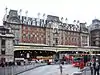 | ۲۴ دسامبر ۱۸۶۸ | Connects with خط ویکتوریا line and Victoria main line station. | ۵۱°۲۹′۴۸″ شمالی ۰۰۰°۰۸′۴۱″ غربی |
| ایستگاه متروی میدان اسلون | 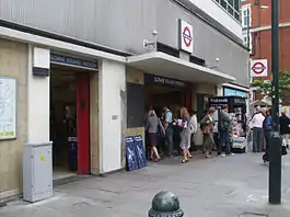 | ۲۴ دسامبر ۱۸۶۸ | ۵۱°۲۹′۳۳″ شمالی ۰۰۰°۰۹′۲۴″ غربی | |
| ایستگاه متروی کنزینگتون جنوبی | 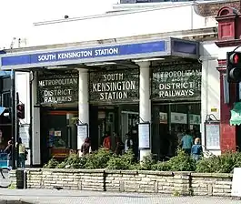 | ۲۴ دسامبر ۱۸۶۸ | Connects with خط پیکدیلی | ۵۱°۲۹′۳۹″ شمالی ۰۰۰°۱۰′۲۶″ غربی |
| ایستگاه متروی گلاستر رود | 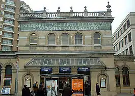 | ۱ اکتبر ۱۸۶۸ | Opened as Brompton (Gloucester Road), renamed in 1907.[2] Connects with خط پیکدیلی and ناحیه lines. | ۵۱°۲۹′۴۱″ شمالی ۰۰۰°۱۰′۵۹″ غربی |
| ایستگاه متروی های استریت کنزینگتون | 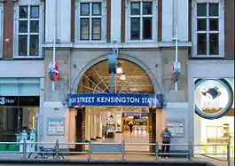 | ۱ اکتبر ۱۸۶۸ | Opened as Kensington (High Street) and name gradually changed by 1880.[2] Connects with خط ناحیه متروی لندن line Edgware Road branch. | ۵۱°۳۰′۰۳″ شمالی ۰۰۰°۱۱′۳۳″ غربی |
| ایستگاه متروی ناتینگ هیل گیت |  | ۱ اکتبر ۱۸۶۸ | Connects with خط مرکزی متروی لندن. | ۵۱°۳۰′۳۲″ شمالی ۰۰۰°۱۱′۴۹″ غربی |
| ایستگاه متروی بیزواتر | 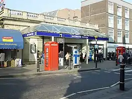 | ۱ اکتبر ۱۸۶۸ | Opened as Bayswater, renamed Bayswater (Queen's Road) & Westbourne Grove in 1923, Bayswater (Queen's Road) in 1933 and Bayswater (Queensway) in 1946, after which the suffix was gradually dropped.[2] | ۵۱°۳۰′۴۳″ شمالی ۰۰۰°۱۱′۱۷″ غربی |
| ایستگاه پادینگتون |  | ۱ اکتبر ۱۸۶۸ | Opened as Paddington (Praed Street), renamed in 1948.[2] Connects with خط بیکرلو and خط همرسمیت و سیتی lines and Paddington main line station. |
The line then continues to Edgware Road where trains terminate, then reverse to traverse the loop in an anticlockwise direction to Hammersmith.
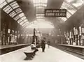
نگارخانه
 ۱۸۹۲
۱۸۹۲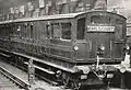 ۱۹۰۰
۱۹۰۰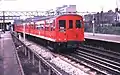 ۱۹۸۰
۱۹۸۰ ۲۰۱۳
۲۰۱۳
توضیحات
- combined figures for Circle and Hammersmith & City lines
منابع
- "Performance: LU Performance Data Almanac". Transport for London. 2012. Retrieved 17 January 2013.
- Rose 2007.
- "Modernisation complete as Shepherd's Bush Tube station re-opens" (Press release). Transport for London. 7 October 2008. Retrieved 6 February 2013.
- "New Wood Lane Underground station opens" (Press release). Transport for London. 14 October 2008. Retrieved 8 December 2012.
- "Latimer Road station to close for three months for engineering works" (Press release). Transport for London. 14 January 2011.
- Butt 1995, p. 244.
- Butt 1995, p. 200.
- Jackson 1986, p. ۷۰.
- Jackson 1986, p. 110.
- Butt, R. V. J. (1995). The Directory of Railway Stations: details every public and private passenger station, halt, platform and stopping place, past and present (1st ed.). Patrick Stephens Ltd. ISBN 1-85260-508-1.
- Bruce, J Graeme (1983). Steam to Silver. A history of London Transport Surface Rolling Stock. Capital Transport. ISBN 0-904711-45-5.
- Day, John R; Reed, John (2010). The Story of London's Underground. Capital Transport. ISBN 978-1-85414-341-9.
- Green, Oliver (1987). The London Underground: An illustrated history. Ian Allan. ISBN 0-7110-1720-4.
- Horne, Mike (2003). The Metropolitan Line. Capital Transport. ISBN 1-85414-275-5.
- Jackson, Alan (1986). London's Metropolitan Railway. David & Charles. ISBN 0-7153-8839-8.
- Rose, Douglas (December 2007) [1980]. The London Underground: A Diagrammatic History (8th ed.). Capital Transport. ISBN 978-1-85414-315-0.
- Simpson, Bill (2003). A History of the Metropolitan Railway. Volume 1: The Circle and Extended Lines to Rickmansworth. Lamplight Publications. ISBN 1-899246-07-X.
- Croome, Desmond F. (1 February 2003). Circle Line. Capital Transport. ISBN 978-1-85414-267-2.
- London Railway Map. Quail Maps. 2001. ISBN 978-1-898319-54-2.
- Yonge, John (November 2008) [1994]. Jacobs, Gerald, ed. 5: Southern & TfL. Railway Track Diagrams (3rd ed.). Bradford on Avon: Trackmaps. ISBN 978-0-9549866-4-3.
پیوند به بیرون
- Circle Line Clive's UndergrounD Line Guides
| در ویکیانبار پروندههایی دربارهٔ خط سیرکل موجود است. |
This article is issued from Wikipedia. The text is licensed under Creative Commons - Attribution - Sharealike. Additional terms may apply for the media files.