وایتهال
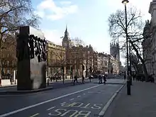
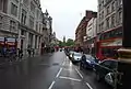
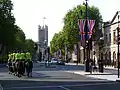
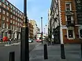
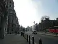
وایتهال (انگلیسی: Whitehall) یک خیابان در لندن، انگلستان است.
 | |
| خطای لوآ در پودمان:Location_map در خط 543: Unable to find the specified location map definition: "Module:Location map/data/United Kingdom London Westminster" does not exist. | |
| نام(های) پیشین | The Street, King Street |
|---|---|
| بخشی از | A3212 |
| نگهداری توسط | Transport for London |
| طول | ۰٫۴ مایل[1] (۰٫۶ کیلومتر) |
| موقعیت | وستمینستر، لندن، بریتانیا |
| کد پستی | SW1 |
| نزدیکترین ایستگاه tube |
|
| مختصات | ۵۱٫۵۰۴۱۶۷°شمالی ۰٫۱۲۶۳۸۹°غربی |
| انتهای شمالی | میدان ترافالگار |
| انتهای جنوبی | The Cenotaph |
| دیگر | |
| شناختهشده برای |
|
این خیابان که در وستمینستر قرار دارد از سمت شمال به میدان ترافالگار و از سمت جنوب به سنوتاف محدود میشود، طول این خیابان ۰/۶ کیلومتر است.[1]
نگارخانه
.jpg.webp) ۱۹۰۴
۱۹۰۴.jpg.webp) دهه ۱۹۳۰
دهه ۱۹۳۰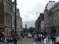
منابع
- "Derby Gate, London to Trafalgar Square". Google Maps. Retrieved 12 June 2016.
- Brown, Colin (2009). Whitehall: The Street that Shaped a Nation. Simon and Schuster. ISBN 978-1-847-37738-8.
- Matthews, Peter (2012). London's Statues and Monuments. Bloomsbury. ISBN 978-0-747-81121-3.
- Moore, Tim (2003). Do Not Pass Go. Vintage. ISBN 978-0-099-43386-6.
- Richardson, John (2000). The Annals of London: A Year-by-year Record of a Thousand Years of History. University of California Press. ISBN 978-0-520-22795-8.
- Shepherd, Robert (2012). Westminster: A Biography: From Earliest Times to the Present. A&C Black. ISBN 978-0-826-42380-1.
- Weinreb, Ben; Hibbert, Christopher; Keay, Julia; Keay, John (2008). The London Encyclopedia. Pan McMillan. ISBN 978-1-4050-4924-5.
This article is issued from Wikipedia. The text is licensed under Creative Commons - Attribution - Sharealike. Additional terms may apply for the media files.
