تدفورد مین
تدفورد مین (به فرانسوی: Thetford Mines) شهرکی در منطقه شهری له آپالاش ناحیه شودییر-آپالاش در استان کبک کانادا است. در سرشماری سال ۲۰۱۱ این شهرک ۲۶٬۱۲۴ نفر جمعیت داشتهاست و مساحت آن ۲۲۴٫۳۷ کیلومتر مربع است.[5]
Thetford Mines | |
|---|---|
شهر | |
 Rue Notre Dame, Downtown Thetford Mines | |
| شعار(ها): | |
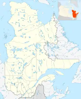 Thetford Mines موقعیت در کبک، کانادا | |
| مختصات (144, rue Notre-Dame Ouest[1]): ۴۶°۰۶′ شمالی ۷۱°۱۸′ غربی[2] | |
| کشور | |
| استان | |
| ناحیه | شودییر-آپالاش |
| منطقه شهری | له آپالاش |
| بنیانگذاری | ۱۸۷۶ |
| Constituted | ۱۷ اکتبر ۲۰۰۱ |
| مدیریت | |
| • شهردار | Luc Berthold |
| • Federal riding | Mégantic—L'Érable |
| • Prov. riding | Lotbinière-Frontenac |
| مساحت | |
| • شهر | ۲۲۷٫۷۰ کیلومتر مربع (۸۸ مایل مربع) |
| • خشکی | ۲۲۶٫۸۲ کیلومتر مربع (۸۸ مایل مربع) |
| • کلانشهری | ۴۰۶٫۹۸ کیلومتر مربع (۱۶۰ مایل مربع) |
| جمعیت | |
| • شهر | ۲۵٬۷۰۹ |
| • تراکم | ۱۱۳٫۳/کیلومتر مربع (۲۹۳/مایل مربع) |
| • کلانشهری | ۲۷٬۹۶۸ |
| • تراکم کلانشهری | ۶۸٫۷/کیلومتر مربع (۱۷۸/مایل مربع) |
| • Change (2006–11) | ۰٫۰% |
| • Dwellings | ۱۲۴۹۲ |
| نام اهلیت(ها) | Thetfordois, Thetfordoises |
| منطقه زمانی | یوتیسی −۵ (EST) |
| • تابستان (ساعت تابستانی) | یوتیسی −۴ (EDT) |
| Postal code(s) | G6G |
| پیششماره(های) تلفن | 418 and 581 |
| زمینکدیابی | 24 31084 |
| وبگاه | |
جستارهای وابسته
منابع
- Geographic code 31084 in the official Répertoire des municipalités (فرانسوی)
- Reference number 293447 of the Commission de toponymie du Québec (فرانسوی)
- "(Code 2431084) Census Profile". 2011 census. اداره آمار کانادا. 2012.
- Thetford Mines (Census agglomeration), Quebec 2011 Census Profile. The census agglomeration consists of Thetford Mines, سن-آدریان-دیرلاند، کبک, سن-ژوزف-دو-کولرن، کبک. In the 2006 census, the census agglomeration had not included Saint-Joseph-de-Coleraine.
- "www.mamrot.gouv.qc.ca". اداره آمار کانادا. Archived from the original on 8 October 2014. Retrieved 6 Jan 2013.
| Subdivisions |
|
|---|---|
| Communities |
|
| Major cities | |
Administrative divisions of Quebec |
| شهرها و شهرکها | |
|---|---|
| شهرداریها | |
| پریشها | |
This article is issued from Wikipedia. The text is licensed under Creative Commons - Attribution - Sharealike. Additional terms may apply for the media files.