به-کومو
به-کومو (به فرانسوی: Baie-Comeau) شهرکی در منطقه شهری مانیکواگان ناحیه کوت-نور در استان کبک کانادا است. در سرشماری سال ۲۰۱۱ این شهرک ۲۲٬۶۱۳ نفر جمعیت داشتهاست و مساحت آن ۳۷۱٫۶۹ کیلومتر مربع است.[8]
Baie-Comeau | |
|---|---|
شهر | |
 Baie-Comeau Mansion | |
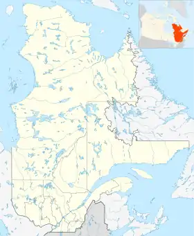
 Map of RCM with Baie-Comeau highlighted | |
 Baie-Comeau | |
| مختصات (19, avenue Marquette[1]): ۴۹°۱۳′ شمالی ۶۸°۰۹′ غربی[2] | |
| کشور | |
| استان | |
| ناحیه | کوت-نور |
| منطقه شهری | مانیکواگان |
| Founded | 1936 |
| Constituted | June 23, 1982 |
| مدیریت | |
| • شهردار | Christine Brisson |
| • Federal riding | Manicouagan |
| • Prov. riding | René-Lévesque |
| مساحت | |
| • شهر | ۴۳۲٫۰۰ کیلومتر مربع (۱۷۰ مایل مربع) |
| • خشکی | ۳۳۸٫۹۹ کیلومتر مربع (۱۳۰ مایل مربع) |
| • شهری | ۱۱٫۳۰ + ۸٫۴۲ کیلومتر مربع (۱۵ مایل مربع) |
| • کلانشهری | ۱۱۳۷٫۲۷ کیلومتر مربع (۴۴۰ مایل مربع) |
| Two urban areas: Baie-Comeau proper + Hauterive | |
| بلندی | ۲۱٫۶۰ متر (۷۰٫۸۷ پا) |
| جمعیت | |
| • شهر | ۲۲٬۱۱۳ |
| • تراکم | ۶۵٫۲/کیلومتر مربع (۱۶۹/مایل مربع) |
| • شهری | ۹٬۹۱۷ + ۱۱٬۸۴۴ |
| • کلانشهری | ۲۸٬۷۸۹ |
| • تراکم کلانشهری | ۲۵٫۳/کیلومتر مربع (۶۶/مایل مربع) |
| • Change (2006–11) | ▼۲٫۰% |
| • Dwellings | ۱۰۲۲۲ |
| Two urban areas: Baie-Comeau proper + Hauterive | |
| منطقه زمانی | یوتیسی −۵ (EST) |
| • تابستان (ساعت تابستانی) | یوتیسی −۴ (EDT) |
| Postal code(s) | G4Z, G5C |
| پیششماره(های) تلفن | 418 and 581 |
| وبگاه | |
جستارهای وابسته
منابع
- "Baie-Comeau". Répertoire des municipalités (به French). Ministère des Affaires municipales, des Régions et de l'Occupation du territoire. Archived from the original on 1 May 2012. Retrieved 2012-05-11.
- "Fiche descriptive - Baie-Comeau" (به French). Commission de toponymie du Québec. Retrieved 2010-07-07.
- "Baie-Comeau census profile". 2011 Census of Population. Statistics Canada. Retrieved 2012-05-11.
- "Baie-Comeau (population centre) census profile". 2011 Census of Population. Statistics Canada. Retrieved 2012-05-11.
- "Hauterive (population centre) census profile". 2011 Census of Population. Statistics Canada. Retrieved 2012-05-24.
- "Baie-Comeau (census agglomeration) census profile". 2011 Census of Population. Statistics Canada. Retrieved 2012-05-11. The census agglomeration consists of Baie-Comeau, شوت-او-اوتارد، کبک, فرانکلن، کبک, پوانت-لوبل، کبک, پوانت-او-اوتارد، کبک, راگنو، کبک. In the 2006 census, the census agglomeration had also included the unorganized territory of Rivière-aux-Outardes.
- Environment Canada – Canadian Climate Normals 1971–2000, accessed 6 April 2012
- "www.mamrot.gouv.qc.ca". اداره آمار کانادا. Archived from the original on 8 October 2014. Retrieved 6 Jan 2013.
| Subdivisions |
|
|---|---|
| Communities |
|
| Major cities | |
| Cities & Towns | |
|---|---|
| Municipalities | |
| Parishes | |
| Villages | |
| Unorganized Territories |
|
| Native reserves (Unassociated with RCM) |
|
| |
Administrative divisions of Quebec |
This article is issued from Wikipedia. The text is licensed under Creative Commons - Attribution - Sharealike. Additional terms may apply for the media files.
