پل سورن
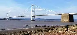
پل سورن (ویلزی: Pont Hafren) یک پل معلق بر روی رود سورون و رود وای مابین کشورهای انگلستان و ولز است.
| پل سورن | |
|---|---|
 The Severn Bridge seen from the English side of the river | |
| مورد استفاده | 4-lane آزادراه ام۴۸ National Cycle Route 4[1] |
| بر روی | رود سورون رود وای |
| مکان | جنوب غربی انگلستان / South East Wales |
| طرح | پل معلق |
| طول | ۰٫۹۹ مایل (۱٫۶ کیلومتر) |
| ارتفاع | ۴۴۵ فوت (۱۳۶ متر) |
| طولانیترین دهنه | ۳٬۲۴۰ فوت (۹۸۸ متر) |
| روزنهٔ پایین | ۱۵۴ فوت (۴۷ متر)[2] |
| سازنده | John Howard & Co. , Sir William Arrol & Co.، Cleveland Bridge & Engineering Company و Dorman Long |
| افتتاح | ۸ سپتامبر ۱۹۶۶ |
| عوارض | Car: £6.60 Van: £13.20 HGV: £19.80 Motorcycle: free Disabled-badge holder: free Cyclist: free Pedestrian: free |
| وضعیت میراث | بنای فهرست شده |
| مختصات | ۵۱°۳۶′۳۲″شمالی ۲°۳۸′۱۸″غربی |
| مختصات | ۵۱°۳۶′۳۲″شمالی ۲°۳۸′۱۸″غربی |
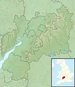
 پل سورن Location in گلاسترشر | |
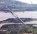
این پل که در سال ۱۹۶۶ ساخته شده از روستای اوست، گلاسترشر شروع و در شهرک چپستاو در ولز به پایان میرسد، پل سورن دارای ۱٫۶ کیلومتر طول و ۱۳۶ متر ارتفاع دارد.
نگارخانه

وسط
منابع
- "the OpenStreetMap Cycle Map". OpenCycleMap.org. Retrieved 2016-09-09.
- "Severn Bridge". 8 June 2005. Retrieved 8 September 2012.
- مشارکتکنندگان ویکیپدیا. «Severn Bridge». در دانشنامهٔ ویکیپدیای انگلیسی، بازبینیشده در ۱۳ ژانویه ۲۰۱۷.
پیوند به بیرون
| در ویکیانبار پروندههایی دربارهٔ پل سورن موجود است. |
- Severn River Crossing PLC
- Severn Bridge در وبگاه structurae.de
- ST58NE Aust M4 motorway – Images of England (photos of listed buildings)
- Bridge celebrates 40th birthday (video), BBC News, 8 September 2006
- Archive pictures of the bridge being built (BBC)
- Video of the Queen opening the bridge in 1966 (BBC)
- Motorway Database: M48
- Severn Bridge traffic webcam بایگانیشده در ۱۹ آوریل ۲۰۱۳ توسط Archive.today
This article is issued from Wikipedia. The text is licensed under Creative Commons - Attribution - Sharealike. Additional terms may apply for the media files.


