مناطق دولت محلی در استرالیای جنوبی
مناطق دولت محلی در استرالیای جنوبی (انگلیسی: Local government areas of South Australia) سازمانها و فرایندهایی را مشخص میکند که در آن شهرها و مناطق می توانند امور خود را تا حد مجاز در بخش ۶۴ ای قانون اساسی ۱۹۳۴ استرالیا مدیریت کنند.[1] این مناطق شامل جدول زیر است:
بزرگشهر آدلاید
| دولت محلی | شورا | ناحیه | سال استقرار | مساحت | جمعیت(2015)[2] | نقشه | |
|---|---|---|---|---|---|---|---|
| sq mi | Density | ||||||
| City of Adelaide | Adelaide | آدلاید | 1840 | 6 | 1,448 | ۲۳٬۱۶۹ | 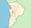 |
| Adelaide Hills Council | وودساید (استرالیای جنوبی) | Metropolitan Adelaide | 1997 | 307 | 50 | ۴۰٬۰۳۱ | 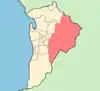 |
| City of Burnside | توسور، استرالیای جنوبی | Metropolitan Adelaide | 1856 | 10 | 1,668 | ۴۵٬۰۳۴ |  |
| City of Campbelltown | Rostrevor | Metropolitan Adelaide | 1854 | 9 | 2,162 | ۵۱٬۸۸۹ | 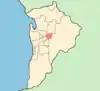 |
| City of Charles Sturt | وودویل، استرالیای جنوبی | Metropolitan Adelaide | 1997 | 20 | 2,196 | ۱۱۴٬۲۰۹ | 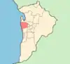 |
| Town of Gawler | گاولر | Metropolitan Adelaide | 1857 | 16 | 552 | ۲۲٬۶۱۸ | 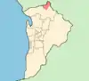 |
| City of Holdfast Bay | برایتن (استرالیای جنوبی) | Metropolitan Adelaide | 1997 | 5 | 2,866 | ۳۷٬۲۶۳ | 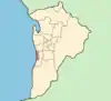 |
| City of Marion | استورت، استرالیای جنوبی | Metropolitan Adelaide | 1853 | 22 | 1,589 | ۸۸٬۹۸۳ | [[:en:File:Adelaide-LGA-Marion-MJC.png|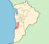 ]] ]] |
| City of Mitcham | Torrens Park | Metropolitan Adelaide | 1853 | 29 | 873 | ۶۶٬۳۴۷ | [[:en:File:Adelaide-LGA-Mitcham-MJC.png| ]] ]] |
| City of Norwood Payneham & St Peters | نوروود، استرالیای جنوبی | Metropolitan Adelaide | 1997 | 6 | 2,490 | ۳۷٬۳۵۰ | [[:en:File:Adelaide-LGA-Norwood-MJC.png|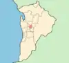 ]] ]] |
| City of Onkaparinga | نورلانگا سنتر، استرالیای جنوبی | Metropolitan Adelaide | 1997 | 200 | 326 | ۱۶۸٬۷۹۸ | [[:en:File:Adelaide-LGA-Onkaparinga-MJC.png|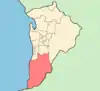 ]] ]] |
| City of Playford | الیزابت، استرالیای جنوبی | Metropolitan Adelaide | 1997 | 133 | 256 | ۸۸٬۲۲۲ | [[:en:File:Adelaide-LGA-Playford-MJC.png|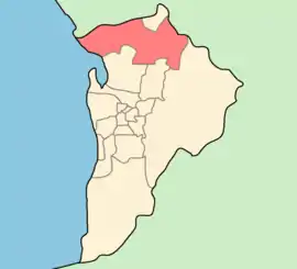 ]] ]] |
| City of Port Adelaide Enfield | بندر آدلاید | Metropolitan Adelaide | 1997 | 37 | 1,276 | ۱۲۳٬۷۵۴ | [[:en:File:Adelaide-LGA-Port_Adelaide-MJC.png|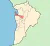 ]] ]] |
| City of Prospect | پراسپکت (استرالیای جنوبی) | Metropolitan Adelaide | 1872 | 3 | 2,677 | ۲۱٬۴۱۶ | [[:en:File:Adelaide-LGA-Prospect-MJC.png|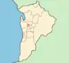 ]] ]] |
| City of Salisbury | سالیسبوری، ساوت استرالیا | Metropolitan Adelaide | 1933 | 61 | 877 | ۱۳۸٬۵۳۵ | [[:en:File:Adelaide-LGA-Salisbury-MJC.png|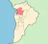 ]] ]] |
| City of Tea Tree Gully | مادبری، استرالیای جنوبی | Metropolitan Adelaide | 1858 | 37 | 1,041 | ۹۸٬۸۶۱ | [[:en:File:Adelaide-LGA-Tea_Tree_Gully-MJC.png|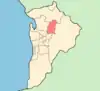 ]] ]] |
| City of Unley | آنلی، استرالیای جنوبی | Metropolitan Adelaide | 1871 | 5 | 2,809 | ۳۹٬۳۲۴ | [[:en:File:Adelaide-LGA-Unley-MJC.png|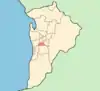 ]] ]] |
| Town of Walkerville | Gilberton | Metropolitan Adelaide | 1855 | 2 | 1,918 | ۷٬۶۷۳ | [[:en:File:Adelaide-LGA-Walkerville-MJC.png|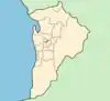 ]] ]] |
| City of West Torrens | هیلتن، استرالیای جنوبی | Metropolitan Adelaide | 1856 | 14 | 1,594 | ۵۸٬۹۶۴ | [[:en:File:Adelaide-LGA-West_Torrens-MJC.png|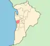 ]] ]] |
بخش استرالیای جنوبی
ایر پنینسولا
| Local government area | Council seat | Region | Year est. | Land area | Pop'n (2015)[3] | Notes | Map | |||
|---|---|---|---|---|---|---|---|---|---|---|
| کیلومتر مربع | مایل مربع | |||||||||
| District Council of Ceduna | سدونا، استرالیای جنوبی | شبهجزیره ایر | 1896 | ۵٬۴۲۷ | ۲٬۰۹۵ | ۲٬۰۹۵ | 2,095 | ۳٬۷۱۶ | [[:en:File:Ceduna_LGA.png| ]] ]] | |
| District Council of Cleve | کلیو، استرالیای جنوبی | Eyre Peninsula | 1911 | ۴٬۵۰۷ | ۱٬۷۴۰ | ۱٬۷۴۰ | 1,740 | ۱٬۷۹۵ | Separated from Franklin Harbour | [[:en:File:Cleve_LGA.png| ]] ]] |
| District Council of Elliston | الیستن (استرالیای جنوبی) | Eyre Peninsula | 1887 | ۶٬۵۰۰ | ۲٬۵۱۰ | ۲٬۵۱۰ | 2,510 | ۱٬۰۶۶ | Boundary changes in 1989 | [[:en:File:Elliston_LGA.png| ]] ]] |
| District Council of Franklin Harbour | کاول | Eyre Peninsula | 1888 | ۳٬۵۸۳ | ۱٬۳۸۳ | ۱٬۳۸۳ | 1,383 | ۱٬۲۳۴ | [[:en:File:Franklin_Harbour_LGA.png|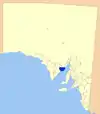 ]] ]] | |
| District Council of Kimba | کیمبا، استرالیای جنوبی | Eyre Peninsula | 1924 | ۳٬۹۸۶ | ۱٬۵۳۹ | ۱٬۵۳۹ | 1,539 | ۱٬۰۹۷ | [[:en:File:Kimba_LGA.png|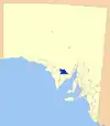 ]] ]] | |
| District Council of Lower Eyre Peninsula | کامینز، استرالیای جنوبی | Eyre Peninsula | 1921 | ۴٬۷۷۱ | ۱٬۸۴۲ | ۱٬۸۴۲ | 1,842 | ۵٬۰۸۷ | Part of District Council of Port Lincoln (proclaimed 1880). District Council of Tumby Bay separated in 1906. Corporation of Port Lincoln separated in 1921. Remainder named District Council of Lincoln. Renamed Lower Eyre Peninsula in 1988. | [[:en:File:Lower_Eyre_Peninsula_LGA.png|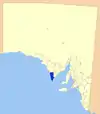 ]] ]] |
| City of Port Augusta | پورت آگوستا | Eyre Peninsula | 1964 | ۱٬۱۵۳ | ۴۴۵ | ۴۴۵ | 445 | ۱۴٬۵۲۲ | [[:en:File:Port_Augusta_LGA.png|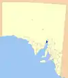 ]] ]] | |
| City of Port Lincoln | پورت لینکلن | Eyre Peninsula | 1921 | ۳۰ | ۱۲ | ۱۲ | 12 | ۱۴٬۹۸۴ | Separated from District Council of Port Lincoln in 1921. Proclaimed a city in 1971. | [[:en:File:Port_Lincoln_LGA.png| ]] ]] |
| District Council of Streaky Bay | استریکی بی، استرالیای جنوبی | Eyre Peninsula | 1887 | ۶٬۲۳۲ | ۲٬۴۰۶ | ۲٬۴۰۶ | 2,406 | ۲٬۲۴۹ | [[:en:File:Streaky_Bay_LGA.png|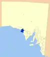 ]] ]] | |
| District Council of Tumby Bay | خلیج تامبی، استرالیای جنوبی | Eyre Peninsula | 1906 | ۲٬۶۱۶ | ۱٬۰۱۰ | ۱٬۰۱۰ | 1,010 | ۲٬۶۶۸ | Separated from District Council of Port Lincoln | [[:en:File:Tumby_Bay_LGA.png|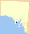 ]] ]] |
| Wudinna District Council | وادینا، استرالیای جنوبی | Eyre Peninsula | 1925 | ۵٬۳۹۴ | ۲٬۰۸۳ | ۲٬۰۸۳ | 2,083 | ۱٬۲۸۲ | Established as the District Council of Minnipa. Later renamed as District Council of Le Hunte. Given present name in 2008. | [[:en:File:Le_Hunte_LGA.png|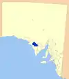 ]] ]] |
| City of Whyalla | وایالا | Eyre Peninsula | 1970 | ۱٬۰۳۳ | ۳۹۹ | ۳۹۹ | 399 | ۲۲٬۷۵۹ | [[:en:File:Whallya_LGA.png| ]] ]] | |
ناحیه مرکزی
| Local government area | Council seat | Region | Year est. | Land area | Pop'n (سرشماری 2006) | Notes | Map | |||
|---|---|---|---|---|---|---|---|---|---|---|
| کیلومتر مربع | مایل مربع | |||||||||
| Adelaide Plains Council | مالالا، ساوت استرالیا | Central | 1935 | ۹۳۲ | ۳۶۰ | ۳۶۰ | 360 | ۸٬۳۸۵ | Amalgamation of the district councils of Grace, Dublin and Port Gawler | [[:en:File:Mallala_LGA.png| ]] ]] |
| Barossa Council | انگاستون | Central | 1996 | ۹۱۲ | ۳۵۲ | ۳۵۲ | 352 | ۲۲٬۵۱۴ | Amalgamation of district councils of Angaston, Barossa, Tanunda and, since 1997, part of Mount Pleasant | [[:en:File:Barossa_LGA.png| ]] ]] |
| District Council of Barunga West | بندر بروتون، استرالیای جنوبی | Central | 1997 | ۲٬۶۳۱ | Amalgamation of the District Council of Bute and the District Council of Port Broughton | [[:en:File:Barunga_West_LGA.png| ]] ]] | ||||
| District Council of Clare and Gilbert Valleys | کلر، استرالیای جنوبی | Central | 1997 | ۸٬۷۴۳ | Amalgamation of the district councils of Clare, Riverton and Saddleworth and Auburn | [[:en:File:Clare_and_Gilbert_Valleys_LGA.png| ]] ]] | ||||
| Copper Coast Council | کادینا، استرالیای جنوبی | Central | 1997 | ۷۷۳ | ۲۹۸ | ۲۹۸ | 298 | ۱۲٬۹۰۱ | Amalgamation of the District Council of Northern Yorke Peninsula and Corporate Town of Wallaroo | [[:en:File:Copper_Coast_LGA.png|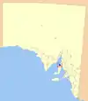 ]] ]] |
| Flinders Ranges Council | کورن، استرالیای جنوبی | Central | 1997 | ۴٬۱۹۸ | ۱٬۶۲۱ | ۱٬۶۲۱ | 1,621 | ۱٬۷۸۴ | Amalgamation of the District Council of Kanyaka-Quorn and the District Council of Hawker | [[:en:File:Flinders_Ranges_LGA.png|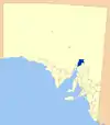 ]] ]] |
| Regional Council of Goyder | بورا، استرالیای جنوبی | Central | 1997 | ۶٬۷۱۹ | ۲٬۵۹۴ | ۲٬۵۹۴ | 2,594 | ۴٬۲۸۵ | Amalgamation of the district councils of Burra Burra Eudunda, Hallet and Robertstown. | [[:en:File:Goyder_LGA.png|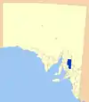 ]] ]] |
| Light Regional Council | کاپوندا | Central | 1996 | ۱٬۲۷۸ | ۴۹۳ | ۴۹۳ | 493 | ۱۳٬۶۵۸ | Amalgamation of the District Council of Light (1977–1996) and the District Council of Kapunda | [[:en:File:Light_LGA.png|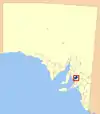 ]] ]] |
| District Council of Mount Remarkable | ملروس، استرالیای جنوبی | Central | 1980 | ۳٬۴۲۵ | ۱٬۳۲۲ | ۱٬۳۲۲ | 1,322 | ۲٬۹۵۱ | Amalgamation of District Council of Port Germein and District Council of Wilmington | [[:en:File:Mt_Remarkable_LGA.png|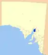 ]] ]] |
| Northern Areas Council | جیمزتاون، ساوت استرالیا | Central | 1997 | ۴٬۸۶۶ | Amalgamation of the district councils of Rocky River, Spalding, and Jamestown | [[:en:File:Northern_Areas_LGA.png|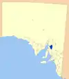 ]] ]] | ||||
| District Council of Orroroo Carrieton | اورورو، استرالیای جنوبی | Central | 1997 | ۹۳۸ | Amalgamation of the District Council of Orroroo and District Council of Carrieton | [[:en:File:Orroroo_Carierton_LGA.png|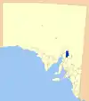 ]] ]] | ||||
| District Council of Peterborough | پیتربورو، استرالیای جنوبی | Central | 1935 | |||||||
| Port Pirie Regional Council | پورت پیری | Central | 1997 | ۱٬۷۶۱ | ۶۸۰ | ۶۸۰ | 680 | ۱۸٬۰۷۶ | Amalgamation of the City of Port Pirie and the District Council of Crystal Brook-Redhill | [[:en:File:Port_Pirie_LGA.png|پرونده:Port Pirie LGA.png]] |
| Wakefield Regional Council | بالاکلاوا | Central | 1997 | ۳٬۴۶۹ | ۱٬۳۳۹ | ۱٬۳۳۹ | 1,339 | ۶٬۸۸۶ | Amalgamation of the District Council of Blyth-Snowtown and District Council of Wakefield Plains | [[:en:File:Wakefield_LGA.png|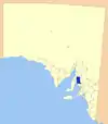 ]] ]] |
| Yorke Peninsula Council | میتلند، استرالیای جنوبی | Central | 1997 | ۵٬۸۳۴ | ۲٬۲۵۳ | ۲٬۲۵۳ | 2,253 | ۱۱٬۷۳۶ | Established as the District Council of Yorke Peninsula in 1997 by amalgamation of the district councils of Central Yorke Peninsula, Minlaton, Warooka and Yorketown.
Renamed in 2013. |
[[:en:File:Yorke_Peninsula_LGA.png|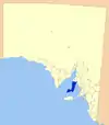 ]] ]] |
ناحیه جنوبی
| Local government area | Council seat | Region | Year est. | Land area | Pop'n (سرشماری 2006) | Notes | Map | |||
|---|---|---|---|---|---|---|---|---|---|---|
| کیلومتر مربع | مایل مربع | |||||||||
| Alexandrina Council | گولوا | Southern and Hills | 1997 | ۱٬۸۲۷ | ۷۰۵ | ۷۰۵ | 705 | ۲۳٬۱۶۰ | Amalgamation of the District Council of Strathalbyn, the District Council of Port Elliot and Goolwa, and a portion of the District Council of Willunga. | [[:en:File:Alexandrina_LGA.png|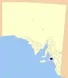 ]] ]] |
| Kangaroo Island Council | کینگزکات، استرالیای جنوبی | Southern and Hills | 1996 | ۴٬۴۰۰ | ۱٬۶۹۹ | ۱٬۶۹۹ | 1,699 | ۴٬۶۱۲ | Amalgamation of the District Council of Kingscote and the District Council of Dudley. | [[:en:File:Kangaroo_Island_LGA.png|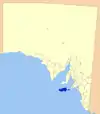 ]] ]] |
| District Council of Mount Barker | مونت بارکر، استرالیای جنوبی | Southern and Hills | 1853 | ۲۹٬۸۶۴ | [[:en:File:Mount_Barker_LGA.png|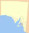 ]] ]] | |||||
| City of Victor Harbor | ویکتور هاربور، استرالیای جنوبی | Southern and Hills | 1975 | ۳۸۷ | ۱۴۹ | ۱۴۹ | 149 | ۱۳٬۶۰۸ | Amalgamation of District Council of Encounter Bay and the Corporation of Victor Harbor in 1975. Formerly a district council, became a city in 2000. | |
| District Council of Yankalilla | یانکالیلا، استرالیای جنوبی | Southern and Hills | 1854 | ۷۵۱ | ۲۹۰ | ۲۹۰ | 290 | ۴٬۵۷۷ | [[:en:File:Yankalilla_LGA.png| ]] ]] | |
ناحیه موری مالی
| Local government area | Council seat | Region | Year est. | Land area | Pop'n (سرشماری 2006) | Notes | Map | |||
|---|---|---|---|---|---|---|---|---|---|---|
| کیلومتر مربع | مایل مربع | |||||||||
| Berri Barmera Council | برری، استرالیای جنوبی | Murray Mallee | 1996 | ۵۰۸ | ۱۹۶ | ۱۹۶ | 196 | ۱۱٬۲۴۰ | Amalgamation of district councils of Barmera and Berri. | [[:en:File:Berri_Barmera_LGA.png| ]] ]] |
| The Coorong District Council | منینگی، استرالیای جنوبی | Murray Mallee | 1995 | ۸٬۸۳۱ | ۳٬۴۱۰ | ۳٬۴۱۰ | 3,410 | ۵٬۸۲۵ | Amalgamation of District Council of Coonalpyn Downs, Peake District Council and Meningie District Council. | [[:en:File:Coorong_LGA.png|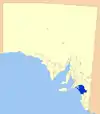 ]] ]] |
| Gerard Community Council | وینکی، استرالیای جنوبی | Murray Mallee | 1974 | ۸۶ | ۳۳ | ۳۳ | 33 | ۹۶ | [[:en:File:Gerard_LGA.png| ]] ]] | |
| District Council of Karoonda East Murray | کاروندا، استرالیای جنوبی | Murray Mallee | 1979 | ۴٬۴۱۵ | ۱٬۷۰۵ | ۱٬۷۰۵ | 1,705 | ۱٬۱۹۳ | Amalgamation of District Council of Karoonda and District Council of East Murray. | [[:en:File:Karoonda_East_Murray_LGA.png|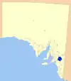 ]] ]] |
| District Council of Loxton Waikerie | لاکستون، استرالیای جنوبی | Murray Mallee | 1997 | ۷٬۹۵۷ | ۳٬۰۷۲ | ۳٬۰۷۲ | 3,072 | ۴٬۶۱۲ | Amalgamation of district councils of Loxton, Waikerie and Browns Well. | [[:en:File:Loxton_Waikerie_LGA.png|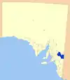 ]] ]] |
| Mid Murray Council | مانام | Murray Mallee | 1997 | ۷٬۹۵۷ | ۳٬۰۷۲ | ۳٬۰۷۲ | 3,072 | ۸٬۵۱۱ | Amalgamation of district councils of Mannum, Morgan, Ridley-Truro and part of the District Council of Mount Pleasant. | [[:en:File:Mid_Murray_LGA.png|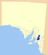 ]] ]] |
| Rural City of Murray Bridge | مورای بریج | Murray Mallee | 1977 | ۱٬۸۳۲ | ۷۰۷ | ۷۰۷ | 707 | ۲۰٬۹۷۱ | [[:en:File:Murray_Bridge_LGA.png|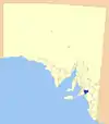 ]] ]] | |
| Renmark Paringa Council | رنمارک، استرالیای جنوبی | Murray Mallee | 1996 | ۹۱۶ | ۳۵۴ | ۳۵۴ | 354 | ۹٬۸۸۲ | Amalgamation of Town of Renmark and the District Council of Paringa. | [[:en:File:Renmark_Paringa_LGA.png| ]] ]] |
| Southern Mallee District Council | پینارو (استرالیای جنوبی) | Murray Mallee | ۶٬۰۰۰ | ۲٬۳۱۷ | ۲٬۳۱۷ | 2,317 | ۲٬۱۸۹ | [[:en:File:Southern_Mallee_LGA.png|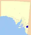 ]] ]] | ||
ناحیه جنوبشرقی
| Local government area | Council seat | Region | Year est. | Land area | Pop'n (سرشماری 2006) | Notes | Map | |||
|---|---|---|---|---|---|---|---|---|---|---|
| کیلومتر مربع | مایل مربع | |||||||||
| District Council of Grant | ماونت گامبیر | Southeast | 1996 | ۱٬۹۰۴ | ۷۳۵ | ۷۳۵ | 735 | ۸٬۶۵۲ | Amalgamation of District Councils of Mount Gambier and Port MacDonnell. | [[:en:File:Grant_LGA.png| ]] ]] |
| Kingston District Council | کینگستون اسایی | Southeast | 1873 | ۳٬۳۳۸ | ۱٬۲۸۹ | ۱٬۲۸۹ | 1,289 | ۲٬۴۶۹ | Renamed from Lacepede District Council in 2000. | [[:en:File:Kingston_LGA.png|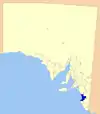 ]] ]] |
| City of Mount Gambier | ماونت گامبیر | Southeast | ۳۰۸ | ۱۱۹ | ۱۱۹ | 119 | ۲۱٬۲۵۶ | [[:en:File:Mt_Gambier_LGA.png| ]] ]] | ||
| Naracoorte Lucindale Council | ناراکورت، استرالیای جنوبی | Southeast | 1993 | ۴٬۵۱۷ | ۱٬۷۴۴ | ۱٬۷۴۴ | 1,744 | ۸٬۴۸۹ | Amalgamation of District Council of Naracoorte, District Council of Lucindale and the Corporate Township of Naracoorte. | [[:en:File:Naracoorte_Lucindale_LGA.png|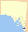 ]] ]] |
| District Council of Robe | روب (استرالیای جنوبی) | Southeast | 1869 | ۱٬۰۹۱ | ۴۲۱ | ۴۲۱ | 421 | ۱٬۴۸۰ | [[:en:File:Robe_LGA.png| ]] ]] | |
| Tatiara District Council | بوردرتاون، استرالیای جنوبی | Southeast | 1876 | ۶٬۴۷۶ | ۲٬۵۰۰ | ۲٬۵۰۰ | 2,500 | ۶٬۶۶۰ | [[:en:File:Tiatara_LGA.png|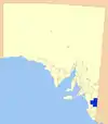 ]] ]] | |
| Wattle Range Council | میلیسنت، استرالیای جنوبی | Southeast | 1997 | ۳٬۹۲۴ | ۱٬۵۱۵ | ۱٬۵۱۵ | 1,515 | ۱۲٬۵۵۴ | Amalgamation of district councils of Beachport, Millicent and Penola. | [[:en:File:Wattle_Range_LGA.png| ]] ]] |
اوتبک
| Local government area | Council seat | Region | Year est. | Land area | Pop'n (سرشماری 2006) | Notes | Map | |||
|---|---|---|---|---|---|---|---|---|---|---|
| کیلومتر مربع | مایل مربع | |||||||||
| Anangu Pitjantjatjara Yankunytjatjara | امووا، استرالیای جنوبی | Outback | 1981 | ۱۰۲٬۶۵۰ | ۳۹٬۶۳۳ | ۳۹٬۶۳۳ | 39,633 | ۲٬۲۳۰ | [[:en:File:APY_LGA.png|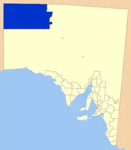 ]] ]] | |
| District Council of Coober Pedy | کوبر پدی | Outback | 1987 | ۷۸ | ۳۰ | ۳۰ | 30 | ۱٬۹۱۳ | [[:en:File:Coober_Pedy_LGA.png| ]] ]] | |
| Maralinga Tjarutja | سدونا، استرالیای جنوبی | Outback | 2006 | ۱۰۲٬۸۶۳ | ۳۹٬۷۱۶ | ۳۹٬۷۱۶ | 39,716 | ۱۰۵ | [[:en:File:MT_LGA.png| ]] ]] | |
| Nepabunna Community Council | Nepabunna | Outback | 1998 | ۷۶ | ۲۹ | ۲۹ | 29 | ۵۳ | [[:en:File:Nepabunna_LGA.png|پرونده:Nepabunna LGA.png]] | |
| Outback Communities Authority | پورت آگوستا | Outback | 1978 | ۶۲۴٬۳۳۹ | ۲۴۱٬۰۵۹ | ۲۴۱٬۰۵۹ | 241,059 | ۳٬۹۵۹ | Covers almost 60 percent of the state's area, mostly in the arid regions of the centre and north. | |
| Municipal Council of Roxby Downs | راکسبای، استرالیای جنوبی | Outback | 1982 | ۱۱۰ | ۴۲ | ۴۲ | 42 | ۴٬۴۸۴ | [[:en:File:Roxby_Downs_LGA.png| ]] ]] | |
| Yalata Community | Outback | 1994 | ۴٬۵۶۳ | ۱٬۷۶۲ | ۱٬۷۶۲ | 1,762 | ۱۰۰ | [[:en:File:Australia-Map-SA-AC-Yalata.png|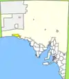 ]] ]] | ||
منابع
- "Constitution Act 1934 – Section 64A". Australasian Legal Information Institute. Government of South Australia. 1934. Retrieved 24 June 2013.
- "3218.0 – Regional Population Growth, Australia, 2014–15". اداره آمار استرالیا. Retrieved 29 September 2016.
- "3218.0 – Regional Population Growth, Australia, 2014–15". Australian Bureau of Statistics. Retrieved 29 September 2016.
- مشارکتکنندگان ویکیپدیا. «Local government areas of South Australia». در دانشنامهٔ ویکیپدیای انگلیسی، بازبینیشده در ۲۶ مارس ۲۰۱۸.
This article is issued from Wikipedia. The text is licensed under Creative Commons - Attribution - Sharealike. Additional terms may apply for the media files.