لومپت
لومپت شهری در کشور کامبوج است که جزو تقسیمات اداری رتناکیری محسوب میشود و جمعیت آن براساس سرشماری سال ۱۹۹۸ میلادی ۱۶٫۹۹۹ نفر بوده که در سال ۲۰۰۵ میلادی به ۲۱٫۸۳۰ نفر افزایش یافتهاست.[1][2]
لومپت លំផាត់ Lumphat | |
|---|---|
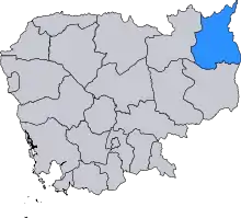
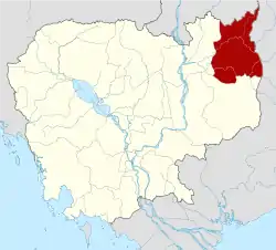 نقشه استان رتناکیری کامبوج | |
 لومپت موقعیت در نقشه کامبوج | |
| مختصات: ۱۳°۲۵′ شمالی ۱۰۷°۰′ شرقیtype:adm1st_region:KH | |
| کشور | |
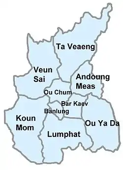
| استان | رتناکیری |
| Communes | Chey Otdam, Ka Laeng, La Bang Muoy, La Bang Pir, Pa Tang, Seda |
| جمعیت استانی | |
| شاخص توسعه انسانی | |
| منطقه زمانی | یوتیسی Cambodia (۷:۰۰+) |
منابع
- "The largest cities in Cambodia, ranked by population". mongabay.com. Archived from the original on 5 July 2012. Retrieved 30 Jun 2012.
- "Cambodia: largest cities and towns and statistics of their population". world-gazetteer. Retrieved 22 May 2012.
This article is issued from Wikipedia. The text is licensed under Creative Commons - Attribution - Sharealike. Additional terms may apply for the media files.
