فهرست فرودگاههای آنتیگوا و باربودا
این مقاله شامل فهرست فرودگاههای آنتیگوا و باربودا است که بر پایهٔ مکان قرارگیری آنها مرتب شدهاست.

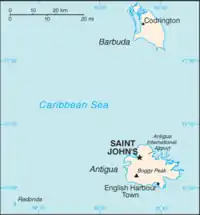
نقشهٔ آنتیگوا و باربودا
فرودگاهها
| شهر | جزیره | ایکائو | یاتا | نام فرودگاه | مختصات |
|---|---|---|---|---|---|
| سینت جانز | آنتیگوا | TAPA | ANU | فرودگاه بینالمللی و. س. برد | ۱۷°۰۸′۱۲″ شمالی ۶۱°۴۷′۳۴″ غربی |
| Codrington | بارابودا | TAPH | BBQ | فرودگاه کودرینگتون | ۱۷°۳۸′۰۹″ شمالی ۶۱°۴۹′۴۳″ غربی |
| Coco Point | بارابودا | TAPT | Coco Point Lodge Airstrip (private) | ۱۷°۳۳′۲۰″ شمالی ۶۱°۴۵′۵۵″ غربی |
جستارهای وابسته
- Transport in Antigua and Barbuda
- فهرست فرودگاهها بر پایه کد ایکائو: T#TA - Antigua and Barbuda
منابع
- "ICAO location Indicators by State" (PDF). ICAO. 17 September 2010.
- "UN Location Codes: Antigua and Barbuda". UN/LOCODE 2011-2. UNECE. 28 February 2012. - includes IATA codes
- Great Circle Mapper: Antigua and Barbuda - IATA codes, ICAO codes and coordinates
This article is issued from Wikipedia. The text is licensed under Creative Commons - Attribution - Sharealike. Additional terms may apply for the media files.
.svg.png.webp)