التناگلوین
التناگلوین (به انگلیسی: Altnagelvin) یک منطقهٔ مسکونی در بریتانیا است.[5]
التناگلوین | |
|---|---|
townland | |
| زبان ایرلندی نویسهگردانی | |
| • Derivation: | Alt na nGealbhán |
| • Meaning: | "Glen/height of the sparrows" |
 Altnagelvin Junction, which in 2004 saw 12930 vehicles pass through every day.[3] بیمارستان آلتناگلوین منطقه is in the background. | |
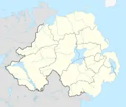 التناگلوین Altnagelvin shown within Northern Ireland  التناگلوین التناگلوین (بریتانیا) | |
| مختصات: ۵۴°۵۸′۵۲″شمالی ۷°۱۷′۱۷″غربی | |
| Sovereign state | بریتانیا |
| Country | ایرلند شمالی |
| County | شهرستان لندندری |
| Barony | Tirkeeran |
| Civil parish | Clondermot |
| Settlements | دری (شهر) |
| مدیریت | |
| • Council | دری و استرابن |
| • Ward | Altnagelvin |
| مساحت | |
| • کل | ۲۹۳٫۳۰ acres (۱۱۸٫۶۹ ha) |
جستارهای وابسته
منابع
- Logainm - Placenames Database of Ireland
- Northern Ireland Roads Site - Derry to Dungiven road
- Northern Ireland Roads Site - Derry to Dungiven road
- Northern Ireland Environment Agency. "NIEA Map Viewer". Archived from the original on 24 November 2011. Retrieved 27 January 2012.
- مشارکت کنندگان ویکیپدیای انگلیسی. «Altnagelvin».
Places in شهرستان لندندری | ||
|---|---|---|
List of places in County Londonderry | ||
| شهرها | 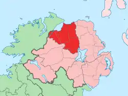 | |
| شهرکها |
| |
| روستاها, parishes, and townlands |
| |
| Landforms |
| |
| Baronies |
| |
| ||
This article is issued from Wikipedia. The text is licensed under Creative Commons - Attribution - Sharealike. Additional terms may apply for the media files.
